
Chulu West Peak Climb is a demanding Himalayan expedition that combines the classic Annapurna Circuit with a technical ascent to one of Nepal’s prominent trekking peaks. Standing at approximately 6,419 meters, Chulu West rises above the Manang Valley, surrounded by rugged ridgelines, glacial terrain, and the dramatic mountain scenery of the Annapurna region. The expedition is suited to adventurous trekkers who want to progress into high-altitude mountaineering with professional climbing support.
The journey begins in Kathmandu and follows the Marsyangdi Valley into the Annapurna region. Traditional settlements, forested hillsides, rivers, and increasingly open mountain landscapes mark the approach to Chame, Upper Pisang, and Manang. This gradual change in scenery also provides time to prepare physically and mentally for the more demanding stages ahead. Manang is a key stop for acclimatization before the route continues toward Leder and Chulu West Base Camp.
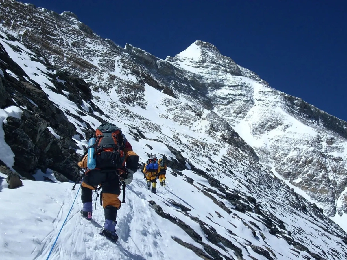
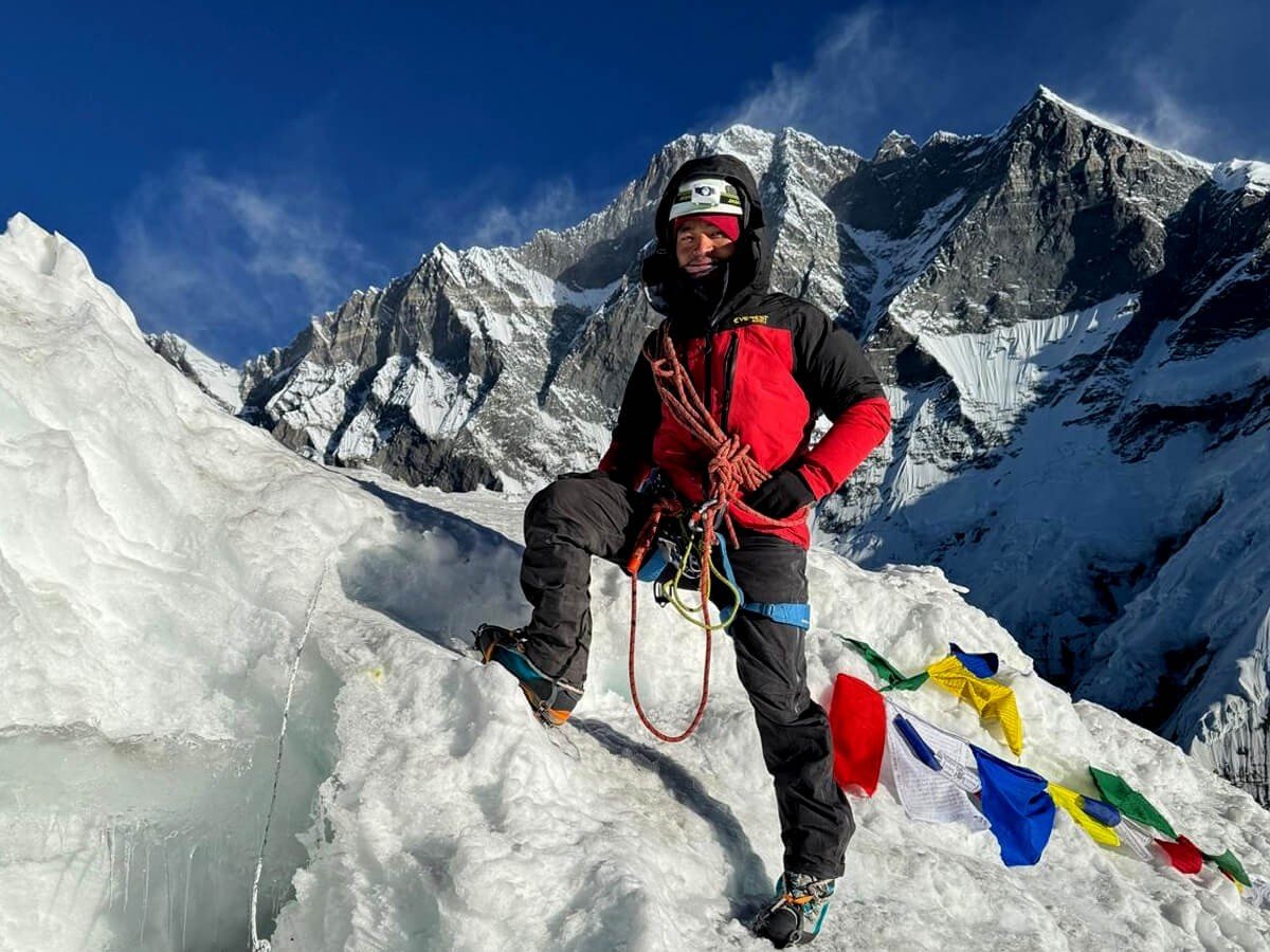
Beyond the main trekking trail, the expedition enters a more remote alpine environment. From base camp, climbers ascend toward higher camps through rocky slopes and exposed mountain terrain. The upper route may involve snow and ice, fixed ropes, crampons, an ice axe, and other technical equipment, depending on the conditions. Reaching high camp is an important stage of the climb, but the summit attempt remains the most demanding part of the expedition due to the elevation, cold, exposure, and physical effort required.
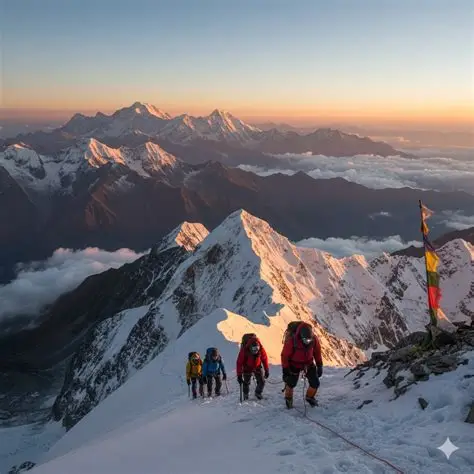
The summit of Chulu West, at approximately 6,419 meters, offers the possibility of extensive Himalayan views in clear weather. The surrounding landscape includes the Annapurna massif, Gangapurna, Tilicho Peak, and the high ridges of the Manang region. The ascent requires careful pacing and disciplined rope and equipment use, while the descent demands equal attention because fatigue and changing conditions can increase the difficulty of the route. A summit cannot be guaranteed, and the climbing guide must assess weather, snow conditions, and each climber’s health before proceeding.
After the climbing section, the itinerary reconnects with the Annapurna Circuit and continues toward Thorong Phedi. Crossing Thorong La Pass at approximately 5,416 meters adds another major high-altitude challenge before the descent to Muktinath and Jomsom. This combination of mountaineering and classic Himalayan trekking makes Chulu West a substantial expedition rather than a standalone summit climb.
Chulu West is not a casual trekking peak. Strong physical endurance, suitable acclimatization, and the ability to follow technical climbing instructions are essential. Previous experience using crampons, an ice axe, and fixed ropes is highly beneficial. Climbers should also be prepared for cold nights, basic accommodation, and changes to the itinerary if conditions become unsafe.
With TrekUp Nepal, the Chulu West Peak Climb package brings together the trekking approach, climbing preparation, high-camp logistics, and onward journey through the Annapurna region. It offers a challenging opportunity for prepared mountaineers to test their skills on a 6,000-meter Himalayan peak while experiencing the landscapes and culture of the Manang and Mustang regions.
Overview
The 18-day Chulu West Peak Climb combines the Annapurna Circuit with a guided ascent of Chulu West at approximately 6,419 meters. Trek through mountain villages to Manang, acclimatize before reaching base camp and high camp, attempt the summit with climbing support, and continue across Thorong La Pass toward Muktinath and Jomsom.
Highlights
- Climb Chulu West Peak at approximately 6,419 meters.
- Follow the Annapurna Circuit through Dharapani, Chame, Pisang, and Manang.
- Acclimatize in the Manang Valley before entering high-altitude climbing terrain.
- Trek to Chulu West Base Camp and establish high camps for the summit attempt.
- Practice essential mountaineering techniques with a qualified climbing guide.
- Experience a demanding summit day across exposed alpine terrain.
- Enjoy views of the Annapurna massif, Gangapurna, and Tilicho Peak when weather permits.
- Cross Thorong La Pass at approximately 5,416 meters.
- Visit Muktinath and continue through the Mustang region toward Jomsom.
- Experience traditional Himalayan villages and Buddhist cultural landmarks.
- Combine technical climbing, high-altitude trekking, and cultural exploration.
- Allow for a contingency day or route adjustment according to climbing conditions.
Itinerary
Arrive at Tribhuvan International Airport, where a TrekUp Nepal representative will meet you and transfer you to your hotel. After check-in, take time to rest following your international journey or explore the nearby streets if your arrival time permits. Your guide or trip coordinator will explain the expedition schedule, review the trekking and climbing equipment requirements, and answer questions about the route. Use the evening to check your personal gear and make a list of any items that need to be rented or purchased before leaving Kathmandu.
Maximum Altitude: Approximately 1,400 m
Walking Duration: Optional short walk around Kathmandu
Driving Duration: Approximately 20–45 minutes from the airport, depending on traffic
Meals: Welcome dinner if included in the confirmed package
Accommodation: Hotel in Kathmandu
Activity: Airport pickup, hotel check-in, and expedition briefing
Spend the day preparing for the expedition and, if included in your package, exploring selected cultural sites in Kathmandu Valley. Visits may include historic squares, Buddhist stupas, and Hindu temples, depending on available time and the agreed sightseeing plan. Your team will also check climbing equipment, organize permits, and confirm transport arrangements for the following morning. The guide will discuss the expected route, acclimatization schedule, equipment needs, and high-altitude safety procedures. Use the remaining time to organize your trekking bag and make sure essential personal items are ready.
Maximum Altitude: Approximately 1,400 m
Walking Duration: Approximately 2–4 hours if sightseeing
Driving Duration: Depends on the sightseeing route and traffic
Meals: Breakfast; other meals according to the confirmed package
Accommodation: Hotel in Kathmandu
Activity: Cultural sightseeing, permit arrangements, and equipment check
Depart Kathmandu and travel toward the Annapurna region by road. The journey follows highways and river valleys before continuing along the road toward Besisahar and the Marsyangdi Valley. You will pass rural settlements, terraced hillsides, and changing landscapes as the route moves away from the city. The final section can be slow because the road is narrow and conditions vary with weather and maintenance. After reaching Syange or the nearest suitable overnight point available for your departure, settle into your lodge and prepare for the trekking stages.
Maximum Altitude: Approximately 1,100 m
Driving Duration: Approximately 7–9 hours, depending on traffic and road conditions
Distance: Approximately 170–200 km by road, depending on the route and access point
Meals: Breakfast, lunch, and dinner according to the confirmed package
Accommodation: Teahouse or lodge in Syange or the agreed overnight village
Activity: Overland journey into the Annapurna region
Begin walking along the Marsyangdi Valley, following village trails and sections of the established Annapurna Circuit route. The path passes waterfalls, river views, cultivated land, and traditional settlements as it gradually gains elevation. Depending on the selected starting point and current trail conditions, some sections may follow the road while others use footpaths above the valley. Walk at a comfortable pace and take regular breaks as you settle into the rhythm of the trek. On arrival in Dharapani, check into your lodge and prepare for the higher elevations ahead.
Maximum Altitude: Approximately 1,860 m
Walking Duration: Approximately 5–7 hours
Distance: Approximately 12–16 km, depending on the starting point and trail
Meals: Breakfast, lunch, and dinner
Accommodation: Teahouse or lodge in Dharapani
Activity: Trekking through river valleys, villages, and forested hillsides
After breakfast, continue through the Marsyangdi Valley toward Chame, the administrative center of Manang District. The trail passes pine forests, rocky slopes, small settlements, and sections of the river valley. As the elevation increases, the surrounding mountains become more prominent, and the air begins to feel cooler. Take a steady pace, stay hydrated, and inform your guide if you notice symptoms that may be related to altitude. Chame offers local lodges and basic facilities where you can rest and prepare for the trek toward Pisang.
Maximum Altitude: Approximately 2,670 m
Walking Duration: Approximately 5–6 hours
Distance: Approximately 14–16 km
Meals: Breakfast, lunch, and dinner
Accommodation: Teahouse or lodge in Chame
Activity: Trekking through forested mountain terrain and traditional settlements
Leave Chame and continue along the valley toward Pisang. The trail passes through pine woodland and rocky terrain, with steep mountain walls and views of the surrounding Himalayan peaks becoming increasingly striking. Depending on the chosen route, you may pass lower Pisang before climbing toward Upper Pisang, which sits above the valley and offers a wider view of the surrounding landscape. Explore the village if time permits, including its traditional architecture and Buddhist cultural features. The day takes you above 3,000 meters, so a slow pace and adequate hydration are important.
Maximum Altitude: Approximately 3,300 m
Walking Duration: Approximately 5–6 hours
Distance: Approximately 13–16 km
Meals: Breakfast, lunch, and dinner
Accommodation: Teahouse or lodge in Upper Pisang
Activity: Mountain trekking, village exploration, and gradual acclimatization
Continue toward Manang through the upper Marsyangdi Valley. The trail passes through alpine settlements and open landscapes, with views of the Annapurna range and surrounding high peaks on clear days. Depending on the selected route, you may follow the higher trail through traditional villages and viewpoints before descending toward Manang. This is an important stage of the approach because the team is moving deeper into high-altitude terrain. Once in Manang, check into your lodge and rest. Your guide will review the acclimatization plan and assess how the group is responding to the elevation before the route continues toward Chulu West.
Maximum Altitude: Approximately 3,540 m
Walking Duration: Approximately 5–7 hours
Distance: Approximately 15–18 km, depending on the selected route
Meals: Breakfast, lunch, and dinner
Accommodation: Teahouse or lodge in Manang
Activity: Trekking through alpine settlements and preparation for acclimatization
Spend an additional night in Manang to help your body adjust before moving higher. Depending on your condition and the guide’s assessment, the day may include a gentle acclimatization walk toward a nearby viewpoint or a longer optional hike to a higher location. The objective is to gain some elevation during the day while returning to sleep at the same altitude. Manang also offers time to explore the village, rest, and prepare personal equipment for the climbing section. Your guide will explain the route toward Leder and Chulu West Base Camp, check the group’s condition, and review the symptoms that should be reported immediately.
Maximum Altitude: Approximately 3,540 m, with a higher optional acclimatization walk
Walking Duration: Approximately 2–5 hours, depending on the chosen walk
Meals: Breakfast, lunch, and dinner
Accommodation: Teahouse or lodge in Manang
Activity: Acclimatization, equipment preparation, and health assessment
Leave Manang and follow the trail toward Yak Kharka and Leder, moving into more open alpine terrain. The landscape becomes drier and more rugged, with sparse vegetation, rocky slopes, and wide views across the high valley. The trail climbs steadily, so maintain a measured pace and take breaks when needed. Leder is a common overnight stop for trekkers and climbers preparing to enter the higher terrain around Chulu West. After reaching the lodge, rest, eat well, and discuss the next day’s approach to base camp with your guide.
Maximum Altitude: Approximately 4,200 m
Walking Duration: Approximately 4–5 hours
Distance: Approximately 8–11 km
Meals: Breakfast, lunch, and dinner
Accommodation: Teahouse or lodge in Leder
Activity: High-altitude trekking and preparation for the climbing section
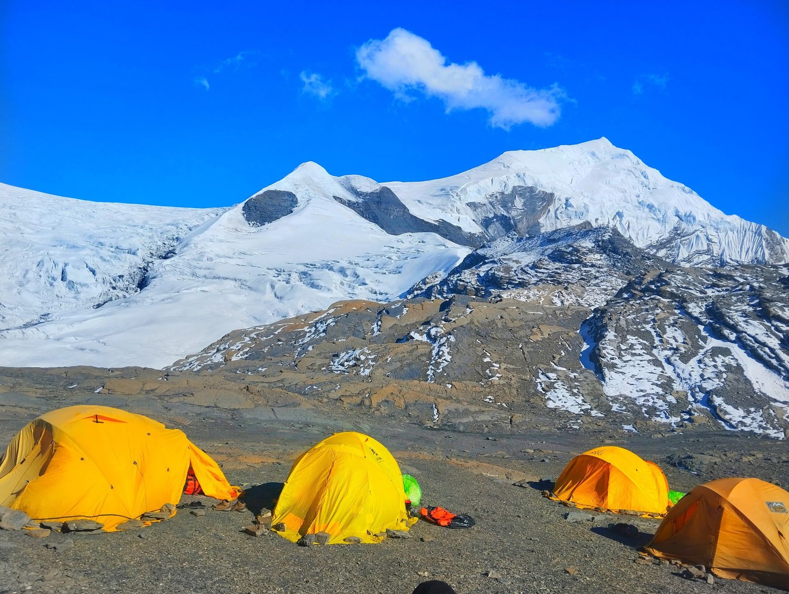
Leave the main trekking route and continue toward Chulu West Base Camp. The trail becomes more remote and rugged, passing through alpine ground and rocky slopes with fewer facilities than the villages below. The ascent requires careful footing and a slow pace as the group approaches 5,000 meters. Upon arrival, the climbing crew will organize tents, food supplies, and camp equipment. Your guide will explain the next stage of the ascent, check your personal gear, and review the safety procedures for moving through exposed terrain. Spend the rest of the day resting and hydrating rather than taking on unnecessary exertion.
Maximum Altitude: Approximately 4,900 m
Walking Duration: Approximately 4–5 hours
Distance: Approximately 5–7 km, depending on the camp route
Meals: Breakfast, lunch, and dinner
Accommodation: Tented camp at Chulu West Base Camp
Activity: Trekking to base camp, camp setup, and climbing briefing
After breakfast, begin the ascent toward the higher camp used for the summit attempt. The route crosses steeper and more exposed terrain, which may include loose rock, snow, or ice depending on the season. Your climbing guide will determine the safest route and manage the team’s movement through technical sections. Once the group reaches high camp, organize equipment for the following day, check clothing layers, headlamps, harnesses, crampons, and other essential gear. The guide will review the planned summit route, turnaround time, and communication procedures. Conditions at this elevation can be very cold, and rest may be difficult, so conserve energy and follow the team’s instructions.
Maximum Altitude: Approximately 5,530–5,600 m, depending on the selected high-camp location
Walking and Climbing Duration: Approximately 4–5 hours
Distance: Varies according to the route and camp location
Meals: Breakfast, lunch, and dinner, prepared by the expedition team where included
Accommodation: Tented high camp
Activity: High-altitude ascent, equipment checks, and summit preparation
Begin the summit attempt before dawn, when the climbing team may find more suitable conditions on the upper mountain. With your guide, ascend the exposed slopes and upper ridges using the climbing equipment and rope techniques required by the route. Snow, ice, steep sections, and altitude can make progress slow and physically demanding. The guide will set the pace and may turn the team around if conditions, health, or timing make continuing unsafe. From the summit at approximately 6,419 meters, clear weather can provide views across the Annapurna region, including Annapurna II, Gangapurna, and Tilicho Peak. After a brief summit stop, descend carefully to the designated camp. The actual time required depends on weather, snow conditions, and group progress.
Maximum Altitude: Approximately 6,419 m at the summit
Walking and Climbing Duration: Approximately 9–10 hours or longer, depending on conditions
Meals: Breakfast, lunch, and dinner, with summit-day food and drinks arranged by the climbing team
Accommodation: Tented camp at the agreed high camp or lower camp, depending on conditions
Activity: Guided summit attempt and descent
Descend from the Climbing Area toward Thorong Phedi (Approximately 4,450 m)
After the climbing section, descend from the high camp or base-camp area and reconnect with the Annapurna Circuit route. The exact walking plan depends on the team’s location after summit day, weather, and the guide’s assessment of fatigue and safety. Where conditions allow, continue through the high valley toward Thorong Phedi, the staging point for crossing Thorong La Pass. This can be a demanding day following the summit, so the guide may adjust the pace or overnight location if the group needs additional recovery. Once at Thorong Phedi, rest and prepare warm clothing, a headlamp, gloves, and other essentials for the early start across the pass.
Maximum Altitude: Approximately 4,450 m at Thorong Phedi
Walking Duration: Approximately 5–7 hours, depending on the camp location and route
Distance: Varies according to the descent route and overnight stop
Meals: Breakfast, lunch, and dinner
Accommodation: Teahouse or lodge at Thorong Phedi, or a suitable camp if required
Activity: Descent from the climbing area and preparation for Thorong La Pass
Start before dawn for the crossing of Thorong La Pass, one of the highest points on the Annapurna Circuit. The trail climbs gradually at first and then becomes steeper as it approaches the pass. Cold, wind, snow, and altitude can make the crossing strenuous, so follow your guide’s pace and instructions. At the top, take a short break for photographs if the weather allows, then begin the long descent toward Muktinath. The scenery changes noticeably as you enter the drier Mustang region. On arrival in Muktinath, settle into your lodge and recover after the long day. The crossing may be rescheduled or modified if weather or trail conditions are unsafe.
Maximum Altitude: Approximately 5,416 m at Thorong La Pass
Walking Duration: Approximately 7–10 hours
Distance: Approximately 14–18 km, depending on the route and overnight location
Meals: Breakfast, lunch, and dinner
Accommodation: Teahouse or lodge in Muktinath
Activity: Thorong La Pass crossing and descent into the Mustang region
After breakfast, continue toward Jomsom through the arid landscape of lower Mustang. Depending on the confirmed route, you may pass through Kagbeni or follow another suitable trail toward the Kali Gandaki Valley. The terrain is generally more open than the forested lower Annapurna trails, with views of dry mountain slopes, traditional villages, and the broad valley. Walking can be affected by wind, particularly later in the day, so follow the guide’s advice about timing and route conditions. Upon reaching Jomsom, check into your accommodation and prepare for the onward flight to Pokhara.
Maximum Altitude: Approximately 3,800 m at the start in Muktinath
Walking Duration: Approximately 5–7 hours if completing the route on foot
Distance: Approximately 18–22 km, depending on the selected trail
Meals: Breakfast, lunch, and dinner
Accommodation: Teahouse or lodge in Jomsom
Activity: Trekking through Mustang and overnight in Jomsom
After breakfast, transfer to Jomsom Airport for the scheduled flight to Pokhara. The flight usually takes around 20–30 minutes, subject to weather and airline operations, and may offer views of the Kali Gandaki Valley and surrounding mountains when visibility is clear. On arrival in Pokhara, transfer to your hotel and enjoy a more relaxed afternoon following the expedition. You can explore Lakeside or rest at the hotel, depending on your energy and the available time. Because flights in the mountain region can be delayed or cancelled, keep some flexibility in your onward travel arrangements.
Maximum Altitude: Approximately 2,720 m in Jomsom before departure
Walking Duration: Short airport and hotel transfers
Flight Duration: Approximately 20–30 minutes, subject to operations
Meals: Breakfast; other meals according to the confirmed package
Accommodation: Hotel in Pokhara
Activity: Domestic flight and rest after the mountain journey
After breakfast, travel from Pokhara to Kathmandu by tourist bus or the transport option included in your package. The road journey follows river valleys and hill settlements, with travel time depending on traffic, roadwork, and weather. Allow most of the day for the drive. After reaching Kathmandu, transfer to your hotel and enjoy the evening at leisure. This is an opportunity to rest, organize your belongings, or purchase souvenirs before the final departure.
Maximum Altitude: Approximately 1,400 m on arrival in Kathmandu
Driving Duration: Approximately 6–9 hours, depending on traffic and road conditions
Distance: Approximately 200 km by road
Meals: Breakfast; lunch and dinner according to the confirmed package
Accommodation: Hotel in Kathmandu
Activity: Return journey to Kathmandu
Your Chulu West Peak Climb concludes today. Depending on your international flight schedule, enjoy breakfast at the hotel and prepare for your airport transfer. A TrekUp Nepal representative will assist with transportation to Tribhuvan International Airport according to the arrangements confirmed in your package. If you plan to extend your stay in Nepal, additional accommodation or another trip can be arranged separately. Depart with memories of the Annapurna Circuit, the high camps, and the challenge of attempting a 6,419-meter Himalayan summit.
Maximum Altitude: Approximately 1,400 m
Walking Duration: Short hotel and airport transfers
Driving Duration: Approximately 20–45 minutes to the airport, depending on traffic
Meals: Breakfast if included in the confirmed package
Accommodation: Not included after departure unless an extra night is booked
Activity: Airport transfer and departure from Nepal
Includes/Excludes
Cost Includes
- Airport pickup and drop-off in Kathmandu according to the confirmed itinerary.
- Ground transportation from Kathmandu to the Annapurna trekking starting point.
- Required ground transportation along the route as specified in the package.
- Domestic flight from Jomsom to Pokhara, if included in the confirmed arrangement.
- Tourist transportation from Pokhara to Kathmandu.
- Hotel accommodation in Kathmandu and Pokhara for the nights specified in the itinerary.
- Teahouse or lodge accommodation during the trekking section.
- Tented accommodation at Chulu West Base Camp and high camps.
- Breakfast, lunch, and dinner during trekking and climbing days as specified in the package.
- Meals during city stays where explicitly included.
- An experienced trekking guide and qualified climbing guide appropriate to the expedition.
- Chulu West climbing permit and applicable trekking or conservation-area permits.
- Climbing crew and support staff according to the confirmed group size.
- Porters or other load-carrying support where specified in the package.
- Group camping equipment, kitchen equipment, and camp supplies as confirmed.
- Meals and camp support during the climbing section where included.
- Climbing preparation and practical equipment guidance before the summit attempt.
- First-aid supplies carried by the trekking or climbing team.
- Staff wages, meals, accommodation, insurance, and applicable operational expenses.
- Government taxes and service charges applicable to the package.
- Pre-trip briefing and expedition coordination.
Cost Excludes
- International flights to and from Nepal.
- Nepal entry visa fees.
- Travel insurance covering high-altitude mountaineering and emergency helicopter evacuation.
- Personal climbing equipment, including mountaineering boots, crampons, ice axe, harness, helmet, ascender, descender, and suitable clothing, unless specifically included.
- Personal expenses such as laundry, Wi-Fi, phone calls, charging, and hot showers where charged separately.
- Snacks, soft drinks, bottled water, and extra beverages.
- Meals in Kathmandu and Pokhara that are not specified as included.
- Additional hotel nights caused by early arrival, late departure, delays, or itinerary changes.
- Tips for guides, climbing staff, porters, and drivers.
- Personal purchases and optional sightseeing.
- Additional accommodation, meals, or transport arising from itinerary changes beyond the agreed package.
- Helicopter evacuation, medical treatment, and other emergency expenses not covered by the package or insurance.
- Costs arising from flight cancellations, weather delays, or route changes unless expressly included.
- Personal climbing guide if requested beyond the standard staffing arrangement.
- Any service not specifically listed under Cost Includes.
Frequently Asked Questions
Faq's
Chulu West Peak is commonly listed at approximately 6,419 meters above sea level. The expedition also involves overnight stays above 4,000 meters and high camps above 5,000 meters.
A common itinerary takes 18 days, including arrival, preparation, trekking through the Annapurna region, acclimatization, the climbing section, the Thorong La crossing, and return travel. The duration can vary with the route and transport arrangements.
It is a strenuous high-altitude climb involving long trekking days, steep terrain, exposed sections, and potentially snow and ice. The summit day can be especially demanding because of the altitude and technical movement required.
Previous experience with crampons, an ice axe, harnesses, and fixed ropes is strongly beneficial. Chulu West should not be treated as a simple trekking peak. Discuss your experience honestly with TrekUp Nepal before booking so the climbing team can assess whether the route is appropriate for you.
It is not recommended for people without appropriate fitness or preparation. Fit trekkers new to Himalayan climbing may be considered only if they are willing to undertake proper training, have suitable guidance, and meet the climbing team’s requirements. Previous technical climbing experience is an advantage.
Spring, from March to May, and autumn, from September to November, are generally the preferred seasons. April and May and October are popular periods, but the actual summit window depends on snow conditions, wind, visibility, and the climbing guide’s assessment.
The expedition requires a Chulu West climbing permit and applicable trekking or conservation-area permits. Requirements and fees can change, so TrekUp Nepal should confirm the current rules and the permits covered by your package before departure.
Yes. A qualified climbing guide is essential for route planning, technical instruction, equipment use, and decisions about whether conditions are safe enough to continue. The appropriate guide-to-climber ratio should be confirmed according to group size and the route.
Personal equipment generally includes mountaineering boots compatible with crampons, crampons, an ice axe, a climbing harness, a helmet, an ascender, a suitable descender, locking carabiners, a warm down jacket, layered clothing, gloves, a sleeping bag, and glacier sunglasses. Confirm the full equipment list with TrekUp Nepal before departure.
Many climbing items may be available to rent or purchase in Kathmandu, depending on availability and condition. Confirm which personal equipment you need to bring and which group equipment is provided. Boots and other critical items should be checked for fit, compatibility, and suitability.
Accommodation generally includes hotels in Kathmandu and Pokhara, teahouses or lodges along the Annapurna Circuit, and tents at base camp and higher camps. Facilities become more basic at higher elevations, and high-camp conditions can be cold and exposed.
Meals commonly include dal bhat, rice, noodles, soups, potatoes, eggs, vegetables, and other local dishes. During the camping section, meals may be prepared by the expedition kitchen team if that service is included. Confirm which meals are covered during city stays and travel days.
Yes. The route reaches more than 6,000 meters, where altitude-related illness is a serious risk. Acclimatization, gradual ascent, hydration, and reporting symptoms early are essential. Severe or worsening symptoms require immediate assessment and may mean descending instead of continuing.
No. Summit success depends on weather, snow and ice conditions, acclimatization, health, and the guide’s safety assessment. The guide may cancel or turn back the team if conditions are unsafe.
The itinerary should allow flexibility for changing mountain conditions. Some departures include a dedicated reserve day, while others rely on adjustments to the climbing schedule. Confirm the exact contingency arrangement with TrekUp Nepal before booking.
The itinerary presented here includes Thorong La Pass at approximately 5,416 meters after the climbing section. The crossing adds a further demanding day at high altitude. If you prefer to finish after the summit without crossing the pass, ask TrekUp Nepal about an alternative return route.
Jomsom flights depend on weather and operational conditions. Delays or cancellations may require additional accommodation or alternative transport. Keep some flexibility in your travel plans and ensure your insurance covers relevant disruptions and emergency evacuation as applicable.
You should be able to walk for several consecutive days, manage long uphill sections and descents, and sustain a demanding summit day. Preparation should include regular aerobic exercise, hill walking, and strength and endurance training. Fitness does not replace the technical skills and acclimatization needed for the climb.
Yes. Depending on the season and logistics, you can discuss extra acclimatization days, changes to the approach or return route, transport upgrades, and additional accommodation. Any change should be reviewed for its effect on safety, staffing, permits, and overall cost.
You need travel insurance that explicitly covers high-altitude mountaineering to at least 6,419 meters and emergency helicopter evacuation in Nepal. Review the policy wording carefully because many standard travel insurance policies exclude technical climbing or high-altitude activities.