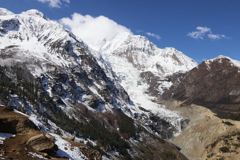
The Gangapurna Expedition is a high-altitude mountaineering journey to the summit of Mount Gangapurna at 7,455 meters in Nepal’s Annapurna region. Rising above the Manang Valley, the mountain forms part of the dramatic Annapurna landscape, where enormous rock walls, glaciated slopes, sharp ridges, and snow-covered summits dominate the horizon. The expedition combines a demanding approach through traditional Himalayan settlements with an extended period of technical climbing, acclimatization, and high-camp operations.
Gangapurna is a serious 7,000-meter objective intended for experienced mountaineers. Its altitude and changing mountain conditions demand more than physical fitness alone. Climbers must be prepared for prolonged exposure to cold, reduced oxygen, steep snow and ice, glacier travel, and potentially difficult ridge sections. Careful route planning, experienced climbing leadership, appropriate equipment, and sufficient time for acclimatization are essential throughout the expedition.
The journey begins in Kathmandu, where the team completes permit formalities, checks equipment, and finalizes the expedition plan. The overland journey toward the Annapurna region follows Nepal’s central highways and the Marsyangdi Valley, passing riverside settlements, terraced hillsides, and increasingly rugged mountain terrain. The approach generally continues through Besisahar and Chame before reaching the upper villages of the Manang region.
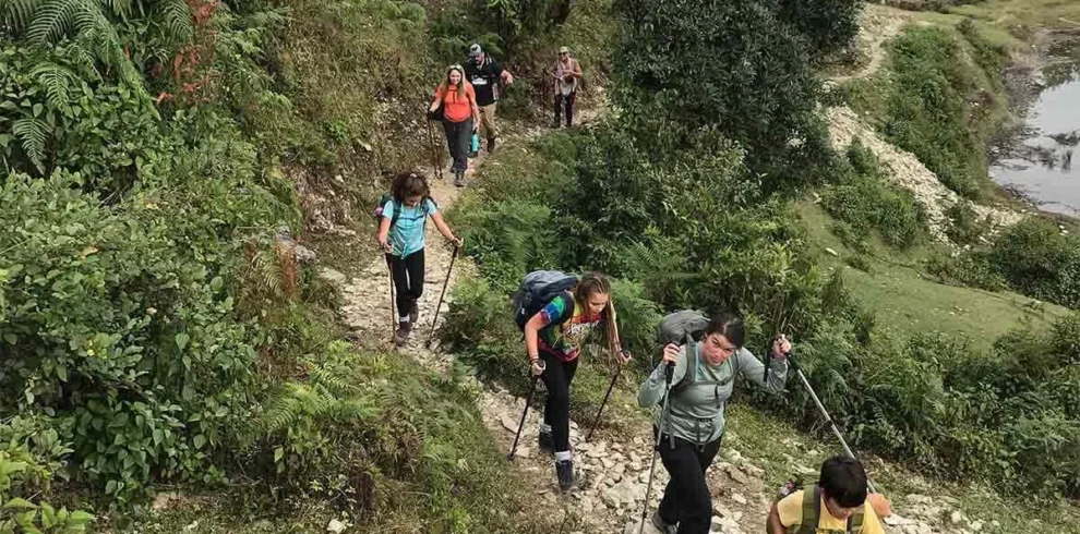
As the route climbs through Chame and Pisang toward Manang, the environment gradually changes from forested valleys to open alpine slopes and dry, high-altitude landscapes. Traditional villages, Buddhist monasteries, prayer walls, and mountain views provide a cultural dimension to the expedition. Manang is an especially important stop because it offers an opportunity to rest, check equipment, and begin adjusting to the thinner air before moving toward Gangapurna Base Camp.
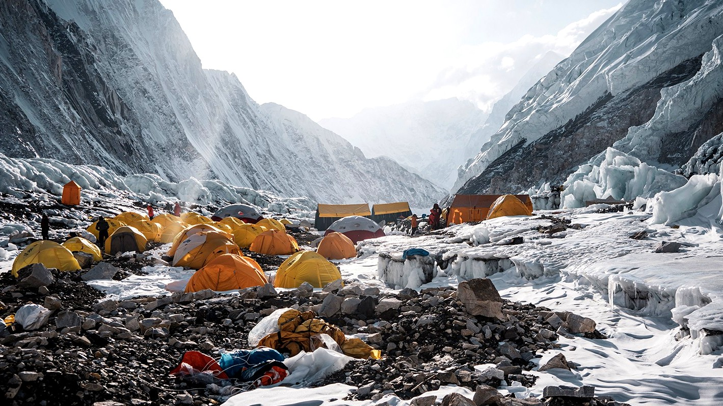
The approach to base camp takes the expedition away from ordinary village trekking and into a more exposed mountain environment. Gangapurna Base Camp is commonly established at approximately 4,600–4,800 meters, depending on the selected route and current conditions. From this point, the expedition enters its main climbing phase, which may involve establishing an advanced base camp and several higher camps. Camp elevations and the number of rotations vary according to the route, snow conditions, team strategy, and the assessment of the expedition leader.
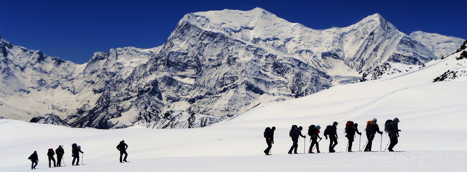
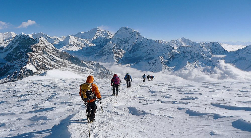
The mountain’s upper sections require disciplined movement and careful management of time, energy, and equipment. Depending on the chosen line, climbers may encounter glaciated terrain, crevasses, steep snow and ice, fixed ropes, exposed ridges, and sections where weather or snow stability can change the level of difficulty. Each camp serves a practical purpose in the acclimatization and summit strategy, allowing climbers and support teams to move equipment, prepare the route, and manage their progress in a controlled way.
The summit attempt is the central objective, but it is only one part of the expedition. At 7,455 meters, the body is under considerable stress, and even routine movements can require substantial effort. Climbers must follow the guidance of their expedition leader, respect turnaround times, and be prepared to retreat if weather, health, or route conditions become unsafe. Supplemental oxygen may be part of the expedition plan, depending on the operator’s strategy and the climber’s individual arrangements; this must be confirmed before departure rather than assumed to be included.
Following the climbing period, the team descends to base camp, dismantles the camp, and retraces the route toward the Manang region. The return may continue through Khangsar and Yak Kharka toward Thorong Phedi, with some itineraries crossing Thorong La Pass at approximately 5,416 meters before descending to Muktinath. The precise exit route depends on the final itinerary, weather, transport access, and the team’s condition after the climb.
Gangapurna is not a suitable first mountaineering objective for inexperienced trekkers. Climbers should have substantial previous high-altitude experience, strong technical skills, and the endurance to manage an expedition lasting several weeks. Preparation must include physical training, equipment checks, insurance that explicitly covers high-altitude mountaineering, and a clear understanding of the risks associated with climbing above 7,000 meters.
With TrekUp Nepal, the Gangapurna Expedition can be organized around the approach trek, climbing permits, high-altitude staff, camp logistics, acclimatization schedule, and return transport. For experienced mountaineers seeking a demanding Himalayan objective, the expedition offers an opportunity to test their skills and endurance on a major peak in the Annapurna range.
Overview
The 35-day Gangapurna Expedition takes experienced mountaineers to the 7,455-meter summit of Mount Gangapurna in Nepal’s Annapurna region. Travel through the Marsyangdi Valley to base camp, complete high-altitude acclimatization and climbing rotations, and attempt the summit with professional expedition support before returning through the Manang region.
Highlights
- Attempt the summit of Mount Gangapurna at 7,455 meters.
- Follow the scenic Marsyangdi Valley into the Annapurna region.
- Explore traditional mountain settlements, including Chame, Pisang, and Manang.
- Spend time acclimatizing before entering the high-altitude climbing zone.
- Establish base camp, advanced base camp, and higher camps according to the selected route.
- Experience technical high-altitude climbing on a major Himalayan peak.
- Undertake climbing rotations to prepare for the summit attempt.
- Navigate glaciated terrain, snow slopes, and exposed sections according to current conditions.
- Enjoy views of the Annapurna massif and surrounding Himalayan peaks in clear weather.
- Benefit from an extended expedition schedule with time for acclimatization and weather contingencies.
- Descend through the Manang region after completing the climbing phase.
- Experience the natural and cultural landscapes of the Annapurna Conservation Area.
Gangapurna Expedition Overview
The Gangapurna Expedition is a serious Himalayan mountaineering undertaking to the 7,455-meter summit of Mount Gangapurna in Nepal’s Annapurna region. It is designed for experienced climbers seeking an extended high-altitude challenge that combines a traditional approach trek, acclimatization rotations, technical climbing, and multi-camp expedition logistics.
The journey begins in Kathmandu and follows the Marsyangdi Valley through Besisahar, Chame, Pisang, and Manang. As the route gains elevation, the landscape changes from forested river valleys to dry alpine slopes and glaciated mountain terrain. After an acclimatization period in Manang, the team continues toward Gangapurna Base Camp, where the main climbing phase begins.
The expedition’s climbing schedule is built around gradual altitude gain, camp establishment, route preparation, and rotations through progressively higher elevations. Depending on the selected route, the team may use advanced base camp and several higher camps before attempting the summit. The upper mountain can involve glacier travel, steep snow and ice, exposed ridges, and fixed-rope sections. These conditions require technical competence, strong endurance, and close coordination with qualified climbing staff.
A successful summit is not guaranteed. Weather, snow conditions, route safety, altitude-related illness, and the team’s overall condition determine whether an attempt can proceed. The expedition leader must retain the authority to delay or cancel the climb when conditions are unsafe. Supplemental oxygen and other specialized equipment must be confirmed as part of the agreed expedition plan.
After the climbing phase, the team descends to base camp, packs out equipment, and returns toward the Manang Valley. Depending on the final route and the team’s condition, the return may continue through Khangsar and Yak Kharka toward Thorong Phedi and Thorong La Pass before reaching Muktinath. The expedition concludes with onward travel through Pokhara to Kathmandu.
What Can You Expect from the Gangapurna Expedition Package?
- A 35-day expedition plan to attempt the summit of Mount Gangapurna at 7,455 meters.
- An approach through the Marsyangdi Valley and traditional settlements of the Annapurna region.
- An acclimatization period in Manang before proceeding to base camp.
- Tented accommodation at base camp and higher camps according to the confirmed route.
- A climbing schedule that includes acclimatization rotations and preparation for the summit attempt.
- Technical climbing on high-altitude snow, ice, and potentially exposed terrain.
- Support from appropriately qualified expedition and climbing staff according to the agreed staffing plan.
- Camp logistics and climbing supplies as specified in the confirmed package.
- An extended climbing period with flexibility for weather and route conditions.
- Guidance on personal equipment, permits, insurance, and expedition preparation.
- A descent through the Manang region after the climbing period.
- An opportunity to experience the natural and cultural landscapes of the Annapurna region alongside a demanding mountaineering objective.
Benefits of Booking Gangapurna Expedition with TrekUp Nepal
- Local expedition coordination: Assistance with transport, accommodation, permits, and logistics throughout the journey.
- Experienced climbing support: An expedition staffing plan appropriate to the mountain, route, and group size.
- Planned acclimatization: A structured schedule for gaining altitude and assessing the team’s response.
- Organized camp logistics: Coordination of base-camp and higher-camp equipment, supplies, and support staff as agreed.
- Route preparation: Planning for climbing rotations and summit attempts according to current mountain conditions.
- Clear package details: An opportunity to review staffing, equipment, oxygen arrangements, inclusions, exclusions, and extra costs before booking.
- Group and private options: Expedition arrangements subject to the technical staffing and logistical needs of the group.
- Practical preparation guidance: Support with equipment checks, fitness preparation, documentation, and insurance requirements.
- Flexible itinerary planning: Assistance with practical adjustments when weather, road access, or the team’s condition changes.
- Safety-led decisions: A commitment to prioritizing climber health and route safety over reaching the summit.
Itinerary
This 35-day expedition begins in Kathmandu and follows the Marsyangdi Valley through Besisahar, Chame, Pisang, and Manang before reaching Gangapurna Base Camp. The main climbing period includes acclimatization rotations, higher-camp preparation, and a summit attempt at 7,455 meters. After returning to base camp, the itinerary descends through the Manang region and may cross Thorong La Pass before continuing to Pokhara and Kathmandu.
Arrive at Tribhuvan International Airport in Kathmandu, where a TrekUp Nepal representative will meet you and transfer you to your hotel. After checking in, rest after your international journey and keep your personal documents and essential equipment accessible. Depending on your arrival time, you may explore the nearby area, but avoid overexertion before the expedition begins. In the evening, meet your coordinator for an initial briefing about the expedition schedule, transport arrangements, and preparation requirements.
Maximum Altitude: Approximately 1,400 m
Walking Duration: Optional short walk
Driving Duration: Approximately 20–45 minutes from the airport, depending on traffic
Meals: Welcome dinner if included in the confirmed package
Accommodation: Hotel in Kathmandu
Activity: Airport pickup, hotel check-in, and initial briefing
Spend the day reviewing the expedition plan and checking the equipment required for a 7,455-meter climb. The team will discuss permits, transportation, camp arrangements, climbing staff, and the proposed acclimatization schedule. Inspect your mountaineering boots, crampons, ice axe, harness, helmet, clothing layers, sleeping equipment, and personal medical supplies. The expedition leader should also review your previous high-altitude climbing experience and identify any additional equipment or arrangements needed before departure. Use the remaining time to obtain missing essentials and organize your luggage into trekking, base-camp, and climbing equipment.
Maximum Altitude: Approximately 1,400 m
Walking Duration: Optional equipment shopping or local sightseeing
Driving Duration: Depends on local transfers
Meals: Breakfast; other meals according to the confirmed package
Accommodation: Hotel in Kathmandu
Activity: Equipment inspection, expedition briefing, and preparation
Complete the remaining official formalities and attend the final expedition briefing. Your team will confirm the route, the expected camp sequence, climbing responsibilities, communication arrangements, and procedures for responding to illness or adverse weather. Discuss the expedition's oxygen strategy, if applicable, including whether supplemental oxygen, regulators, masks, and backup supplies are included or arranged separately. The guide should explain the planned climbing rotations and the circumstances under which the summit attempt may be delayed or cancelled. Keep the day flexible in case administrative tasks or equipment checks require additional time.
Maximum Altitude: Approximately 1,400 m
Walking Duration: Optional short walk
Driving Duration: Depends on administrative appointments and local transfers
Meals: Breakfast; other meals according to the confirmed package
Accommodation: Hotel in Kathmandu
Activity: Permit coordination, safety briefing, and final checks
Leave Kathmandu and travel toward Besisahar, following the main highway before continuing through the hills and river valleys of central Nepal. The journey passes rural settlements, terraced fields, and sections of the Marsyangdi River corridor. Road conditions and traffic can affect the duration, so the schedule should remain flexible. On reaching Besisahar, settle into a lodge and prepare for the journey deeper into the Annapurna region. Use the evening to organize the equipment needed for the following day's drive and trek.
Maximum Altitude: Approximately 1,400 m at departure
Driving Duration: Approximately 5–7 hours, depending on road conditions
Meals: Breakfast, lunch, and dinner
Accommodation: Teahouse or lodge in Besisahar
Activity: Overland travel toward the Annapurna region
Continue by vehicle along the Marsyangdi Valley toward Chame, the administrative center of Manang District. The road passes through mountain settlements, river gorges, forested hillsides, and increasingly dramatic landscapes. Some sections may be rough, narrow, or affected by construction, making travel slower than expected. On arrival in Chame, check into your lodge and prepare for the trekking stages ahead. The elevation gain is significant, so keep the evening relaxed, drink fluids regularly, and report any symptoms that may indicate difficulty adjusting to altitude.
Maximum Altitude: Approximately 2,670 m
Driving Duration: Approximately 4–7 hours, depending on road and vehicle access
Meals: Breakfast, lunch, and dinner
Accommodation: Teahouse or lodge in Chame
Activity: Drive into the upper Marsyangdi Valley
Begin trekking through pine forests, rocky sections, and mountain trails alongside the Marsyangdi River. The route gradually gains elevation and passes dramatic cliffs and viewpoints, with the Annapurna peaks becoming more prominent as the valley opens. Continue toward Pisang and ascend to Upper Pisang, where traditional architecture and Buddhist cultural features reflect the region's Himalayan heritage. Walk at a controlled pace and take regular breaks as you move above 3,000 meters. After reaching the village, rest and prepare for the next stage toward Manang.
Maximum Altitude: Approximately 3,300 m
Walking Duration: Approximately 5–6 hours
Meals: Breakfast, lunch, and dinner
Accommodation: Teahouse or lodge in Upper Pisang
Activity: Trekking through alpine valleys and traditional settlements
Continue along the Annapurna Circuit toward Manang, following a trail through dry mountain slopes, cultivated terraces, and villages influenced by Tibetan Buddhist culture. Depending on the selected route, the trail may pass through Ghyaru and Ngawal, which offer expansive views across the valley, or follow an alternative path based on conditions and the group's pace. The route provides a gradual transition into the higher Manang region, where vegetation becomes sparser and the landscape more open. On arrival in Manang, settle into a lodge and prepare for the acclimatization period before moving toward Gangapurna Base Camp.
Maximum Altitude: Approximately 3,540 m
Walking Duration: Approximately 5–7 hours, depending on the route
Meals: Breakfast, lunch, and dinner
Accommodation: Teahouse or lodge in Manang
Activity: Trekking through the upper Manang Valley
Spend the day allowing your body to adjust to the altitude before proceeding toward base camp. Depending on your condition and the guide's recommendation, undertake a gentle acclimatization walk to a nearby viewpoint or a suitable higher location before returning to Manang. The team will review climbing equipment, discuss the approach to Gangapurna Base Camp, and confirm the expected camp and rotation plan. Rest, eat adequately, and maintain hydration. Report any persistent headache, nausea, dizziness, unusual fatigue, or breathing difficulty promptly; do not continue upward if symptoms suggest altitude illness.
Maximum Altitude: Approximately 3,540 m, with an optional higher acclimatization walk
Walking Duration: Approximately 2–4 hours for an optional walk
Meals: Breakfast, lunch, and dinner
Accommodation: Teahouse or lodge in Manang
Activity: Acclimatization, equipment preparation, and expedition briefing
Leave Manang and move toward Gangapurna Base Camp with the expedition team. The route leaves the more established village trails and enters increasingly rugged alpine terrain, with rocky slopes, moraine, and open mountain ground. The final approach and camp location depend on the selected climbing route and current conditions. As the elevation increases, walking becomes slower and more demanding, so the team should maintain a steady pace and monitor each climber's condition. On arrival, the support crew establishes tents, kitchen facilities, and the equipment required for the climbing phase.
Maximum Altitude: Approximately 4,600–4,800 m, depending on the base-camp location
Walking Duration: Approximately 4–6 hours, depending on the route and load
Meals: Breakfast, lunch, and dinner
Accommodation: Tented expedition camp
Activity: Trek to Gangapurna Base Camp and establish camp
Use the day to organize the base camp and prepare for the climbing period. The expedition leader will review the proposed route, camp elevations, communication arrangements, equipment distribution, and safety procedures. The climbing team may inspect the approach to advanced base camp and assess current snow, ice, and glacier conditions. Complete any remaining gear checks and organize personal equipment into loads for the higher camps. The day should also include rest and altitude monitoring, allowing the team to begin the technical phase in a controlled manner.
Maximum Altitude: Approximately 4,600–4,800 m
Walking Duration: Short acclimatization walks or route inspection, as appropriate
Meals: Breakfast, lunch, and dinner
Accommodation: Tented expedition camp
Activity: Base-camp organization, route assessment, and climbing preparation
The main climbing period is reserved for acclimatization, route preparation, camp establishment, climbing rotations, and the summit attempt. The exact sequence depends on the selected route, weather, snow conditions, the team's health, and the expedition leader's assessment. A common approach includes movement from base camp to advanced base camp, followed by progressively higher camps that may be established around 5,600 meters, 6,300 meters, and 6,800–6,900 meters. These elevations are indicative and must not be treated as fixed camp positions for every expedition.
The early part of the climbing period may involve establishing advanced base camp and making a first rotation to a higher camp before returning to a lower camp for rest. Subsequent rotations allow the team to gain altitude gradually, move equipment, and assess how climbers are responding to the increasing elevation. The climbing staff may prepare sections of the route and manage fixed ropes where required. Climbers must follow the guide's instructions and avoid unnecessary exertion, particularly when moving above 6,000 meters.
The summit push begins only when the expedition leader considers the weather, route, equipment, and team condition suitable. Climbers move through the established camps and continue toward the summit at 7,455 meters according to the agreed plan. The upper mountain may involve steep snow and ice, exposed ridge sections, glacier travel, and changing conditions that require technical judgment. Supplemental oxygen may be used if included in the expedition plan, but the oxygen strategy and supplies must be confirmed before the trip.
After the summit attempt, the team descends through the higher camps and returns to base camp. The schedule allows time for recovery and weather-related changes, but it does not guarantee a successful summit. If conditions become unsafe, the expedition leader may postpone the attempt, alter the route, or cancel the climb. The priority throughout this period is to manage risk, preserve the team's health, and ensure a safe descent.
Maximum Altitude: 7,455 m at the summit, if reached
Walking and Climbing Duration: Variable; individual climbing days may last several hours or extend through a full summit day
Meals: Breakfast, lunch, and dinner at base camp and higher camps according to the expedition's kitchen and supply plan
Accommodation: Tented camps at base camp, advanced base camp, and higher camps according to the selected route
Activity: Acclimatization rotations, camp establishment, technical climbing, summit attempt, and descent
After returning to base camp, complete the camp cleanup and organize the equipment for the descent. The expedition team should remove rubbish and pack out supplies according to responsible mountain practices. Once the team is ready, descend toward Khangsar, following the route back toward the Manang Valley. The change in elevation can make breathing easier, although the descent may still be tiring after several weeks of climbing. On arrival in Khangsar, settle into a lodge and take time to recover from the expedition.
Maximum Altitude: Approximately 4,600–4,800 m at the start, depending on the base camp
Walking Duration: Approximately 4–6 hours, depending on the camp location and route
Meals: Breakfast, lunch, and dinner
Accommodation: Teahouse or lodge in Khangsar
Activity: Base-camp cleanup and descent toward the Manang Valley
Continue through the Manang region toward Yak Kharka, following trails across dry mountain slopes and open alpine terrain. The route may involve a gradual ascent as it reconnects with the upper Annapurna Circuit, so maintain a comfortable pace despite having descended from the climbing area. The landscape features sparse vegetation, rocky slopes, and broad views across the high valley. On arrival in Yak Kharka, rest and review the next day's route with the guide. Depending on the team's condition, the itinerary may be adjusted to avoid unnecessary exertion after the long climbing period.
Maximum Altitude: Approximately 4,050 m
Walking Duration: Approximately 4–6 hours, depending on the route
Meals: Breakfast, lunch, and dinner
Accommodation: Teahouse or lodge in Yak Kharka
Activity: Trek through the upper Manang Valley
Leave Yak Kharka and continue toward Thorong Phedi, the staging point below Thorong La Pass. The trail crosses high-altitude terrain, with rocky slopes and exposed sections that require careful footing. Although the distance is relatively short, the altitude can make the walk tiring. After reaching Thorong Phedi, settle into a lodge and review the weather and trail conditions for the pass crossing. Because the expedition already involves a demanding high-altitude climb, the guide should assess whether the group is sufficiently rested and prepared to continue over the pass or whether the return itinerary needs adjustment.
Maximum Altitude: Approximately 4,450 m at Thorong Phedi
Walking Duration: Approximately 3–5 hours
Meals: Breakfast, lunch, and dinner
Accommodation: Teahouse or lodge in Thorong Phedi
Activity: Trek to the Thorong La staging point and prepare for the crossing
If the group is fit, weather conditions are suitable, and the pass crossing remains part of the confirmed itinerary, begin before dawn and ascend toward Thorong La Pass. The climb is demanding because of the altitude, cold, wind, and long walking hours. Follow the guide's pace and instructions, taking care on snow-covered or icy sections if present. At the pass, stop briefly for photographs if conditions allow, then descend toward Muktinath in the Mustang region. The landscape changes from the high alpine environment to drier mountain slopes. If the group is not sufficiently recovered from the expedition, the guide may recommend an alternative exit rather than attempting the crossing.
Maximum Altitude: Approximately 5,416 m at Thorong La Pass
Walking Duration: Approximately 7–10 hours
Meals: Breakfast, lunch, and dinner
Accommodation: Teahouse or lodge in Muktinath
Activity: High-pass crossing and descent into Mustang
After breakfast, continue toward Jomsom by trekking or vehicle, depending on the selected package and road conditions. Walking provides more time to experience the dry landscapes and settlements of the Kali Gandaki Valley, while vehicle travel can shorten the journey after the demanding pass crossing. On arrival in Jomsom, settle into your accommodation and prepare for the onward journey to Pokhara. The schedule should remain flexible because road conditions and transport availability may change.
Maximum Altitude: Approximately 3,800 m at the start
Walking Duration: Approximately 4–6 hours if trekking
Driving Duration: Approximately 1–2 hours if using road transport, depending on conditions
Meals: Breakfast, lunch, and dinner
Accommodation: Teahouse or lodge in Jomsom
Activity: Travel through the Mustang region
Travel from Jomsom to Pokhara according to the confirmed transport arrangement. A domestic flight is commonly used when operating conditions permit, but schedules depend on weather and airline operations. If a flight is unavailable or the package specifies road transport, the team will coordinate the alternative arrangement. After arriving in Pokhara, check into your hotel and rest after the expedition. The afternoon can be kept free for recovery or a gentle walk around the lakeside area if you feel comfortable.
Maximum Altitude: Approximately 2,720 m at the start
Walking Duration: Short airport or transfer walks
Flight Duration: Approximately 20–30 minutes if flying, subject to operations
Driving Duration: Variable if using road transport
Meals: Breakfast; other meals according to the confirmed package
Accommodation: Hotel in Pokhara
Activity: Transfer to Pokhara and recovery
Travel back to Kathmandu by road or domestic flight according to the confirmed package. Road journeys may take several hours and can be affected by traffic or construction, while flights depend on the operating schedule and weather. On arrival in Kathmandu, transfer to your hotel and take time to rest. The evening may include an expedition debriefing and a review of the journey with your team. If you plan to leave Nepal soon after the expedition, allow sufficient flexibility for possible delays.
Maximum Altitude: Approximately 1,400 m on arrival in Kathmandu
Walking Duration: Short transfer walks
Driving Duration: Approximately 6–8 hours by road, depending on conditions
Meals: Breakfast; other meals according to the confirmed package
Accommodation: Hotel in Kathmandu
Activity: Return journey and expedition debriefing
Your Gangapurna Expedition concludes today. Depending on your international flight schedule, enjoy breakfast at the hotel and organize your luggage before the airport transfer. A TrekUp Nepal representative will assist with the transfer according to the confirmed booking. If you wish to stay longer in Nepal, additional hotel nights or other activities can be arranged separately. Because high-altitude expeditions can be affected by weather, road access, and domestic transport disruptions, it is wise to leave a buffer between the planned expedition return and your international flight.
Maximum Altitude: Approximately 1,400 m
Walking Duration: Short hotel and airport transfers
Driving Duration: Approximately 20–45 minutes to the airport, depending on traffic
Meals: Breakfast if included in the confirmed package
Accommodation: Not included after departure unless extra nights are booked
Activity: Airport transfer and departure from Nepal
Includes/Excludes
Cost Includes
- Airport pickup and drop-off in Kathmandu according to the confirmed itinerary.
- Hotel accommodation in Kathmandu for the nights specified in the package.
- Hotel accommodation in Pokhara if included in the confirmed itinerary.
- Ground transportation between Kathmandu, Besisahar, Chame, and the relevant trekking trailhead according to the selected route.
- Transportation from the trekking exit point to Pokhara and onward to Kathmandu as specified.
- Teahouse or lodge accommodation during the approach and return trek.
- Tented accommodation at Gangapurna Base Camp and higher camps.
- Breakfast, lunch, and dinner during trekking and climbing days as specified in the confirmed package.
- An expedition leader and appropriately qualified climbing guides according to the agreed staffing plan.
- Required Gangapurna climbing permit and applicable trekking or conservation-area permits.
- Porters, climbing Sherpa staff, and other expedition support staff as specified in the package.
- Group camping equipment, kitchen facilities, and camp support where included.
- Climbing route preparation and fixed-rope support where specified in the confirmed plan.
- Technical climbing guidance and expedition coordination.
- First-aid supplies carried by the trekking or climbing team.
- Staff wages, meals, accommodation, insurance, and applicable operational expenses.
- Government taxes and service charges applicable to the package.
- Pre-trip briefing, route planning, and expedition preparation support.
Cost Excludes
- International flights to and from Nepal.
- Nepal entry visa fees.
- Travel insurance that explicitly covers mountaineering at 7,455 meters and emergency helicopter evacuation.
- Supplemental oxygen, oxygen masks, regulators, and backup supplies unless explicitly included.
- Personal climbing equipment, including mountaineering boots, crampons, ice axe, harness, helmet, carabiners, ascender, descender, and suitable clothing, unless specified as included.
- Personal sleeping bag, insulated clothing, gloves, and other individual gear unless stated otherwise.
- Meals in Kathmandu and Pokhara that are not specified as included.
- Extra accommodation or meals caused by early arrival, late departure, weather delays, or itinerary changes.
- Personal expenses such as Wi-Fi, phone calls, laundry, charging, hot showers, and extra beverages.
- Snacks, soft drinks, bottled water, and personal purchases.
- Tips for guides, climbing staff, porters, and drivers.
- Optional sightseeing and additional activities.
- Additional staff, climbing days, camp supplies, or transport beyond the agreed itinerary.
- Emergency evacuation, medical treatment, or rescue expenses not covered by the package or insurance.
- Additional costs resulting from weather delays, route changes, or other unforeseen circumstances unless expressly included.
- Any service not specifically listed under Cost Includes.
Add-ons and Options
Customize your Gangapurna Expedition with additional acclimatization time, transport upgrades, equipment arrangements, or extra accommodation. Because this is a 7,000-meter expedition, additions that affect high-altitude staff, oxygen supplies, fixed ropes, or camp logistics must be confirmed before departure. Prices depend on the season, group size, service provider, and final expedition plan.
Porter or Additional Load-Carrying Support
Price: Available on request
Arrange additional porter or load-carrying support for the trekking approach or selected equipment, subject to the route, weight limits, and staffing plan. Loads for the high-altitude climbing section require separate logistical planning.
Private Jeep for the Overland Journey
Price: Available on request
Choose private ground transportation for selected sections between Kathmandu, Besisahar, Chame, and the trekking access points. The final cost depends on the route, vehicle type, road conditions, and number of travelers.
Domestic Flight between Kathmandu and Pokhara
Price: Available on request
Consider a domestic flight instead of road transport to reduce travel time, subject to the flight schedule, baggage limits, and availability. The selected transport plan should allow sufficient flexibility for delays.
Extra Acclimatization Days
Price: Available on request
Add additional acclimatization days if recommended by the expedition leader. Extra time may require additional accommodation, meals, climbing staff, and camp supplies.
Additional Weather Contingency Days
Price: Available on request
Add reserve days where the expedition schedule and logistics allow. Extra days may provide more flexibility for weather delays, but they cannot guarantee a successful summit attempt.
Supplemental Oxygen Arrangement
Price: Confirmed quote required
Discuss supplemental oxygen, masks, regulators, and backup supplies with TrekUp Nepal before booking. Confirm the planned oxygen strategy, quantities, delivery to the relevant camps, and whether the cost includes equipment and support. Do not assume oxygen is included unless the final package specifies it.
Personal Mountaineering Equipment Rental
Price: Depends on equipment and rental duration
Arrange rental of suitable personal climbing equipment in Kathmandu where available. Confirm the exact list with the expedition leader and check the fit, condition, and suitability of all critical gear before departure.
Hotel Upgrade in Kathmandu or Pokhara
Price: Available on request
Upgrade your accommodation before or after the expedition to a higher hotel category, subject to availability and the selected property.
Extra Night in Kathmandu or Pokhara
Price: Available on request
Add extra accommodation for rest, sightseeing, equipment preparation, or flexibility before and after the expedition.
Private Expedition
Price: Available on request
Arrange a private expedition for your own group, subject to climbing staff availability, route conditions, and a suitable climbing window. Larger groups may need separate climbing teams and additional support staff.
How to Personalize Your Trip
Step 1: Choose Your Departure Date
Step 2: Enter Number of Climbers
Step 3: Select Your Add-ons
Step 4: Review Your Expedition Plan
Step 5: Confirm Your Booking
Best Time to Do Gangapurna Expedition
Spring (March to May)
Spring is one of the main seasons for Gangapurna Expedition. April and May are commonly selected for high-altitude climbing because the approach through the Annapurna region becomes more accessible and the seasonal weather can provide suitable summit windows. However, the upper mountain remains exposed to strong winds, very low temperatures, snow accumulation, and changing visibility. The climbing team must assess snow stability, route conditions, and the forecast before establishing higher camps or beginning the summit push.
Autumn (September to November)
Autumn is another preferred season for Gangapurna. After the monsoon, the Annapurna region often experiences clearer skies and improved visibility, particularly during October and early November. The approach trek can offer excellent mountain views, but the high camps remain cold and exposed. The summit route may still be affected by wind, snow, and changing conditions, so the expedition schedule must remain flexible.
What Our Travelers Say
Read reviews from travelers who have joined our Himalayan trips. See what they enjoyed and what they thought about their experience.
Frequently Asked Questions
Faq's
Mount Gangapurna reaches approximately 7,455 meters above sea level and lies in the Annapurna region of Nepal.
A full expedition commonly takes around 34–40 days, depending on the approach route, acclimatization plan, climbing rotations, weather contingency, and return itinerary. The TrekUp Nepal itinerary presented here is planned for 35 days.
Gangapurna is a demanding 7,000-meter mountaineering expedition. It involves prolonged high-altitude exposure, glacier travel, steep snow and ice, potentially exposed ridge sections, multiple camps, and a strenuous summit attempt. Climbers need substantial previous mountaineering experience, strong endurance, technical skills, and appropriate equipment.
No. Gangapurna should not be treated as a beginner's climbing objective. It is best suited to experienced mountaineers who have already completed demanding high-altitude climbs and can manage technical terrain, extended expeditions, and the physical challenges of climbing above 7,000 meters.
Climbers should have experience with high-altitude mountaineering, crampons, ice axes, fixed ropes, glacier travel, and movement on steep snow or ice. Experience on 6,000-meter peaks can be useful, but the expedition leader should assess each climber's actual experience and readiness before departure.
Spring, particularly April and May, and autumn, especially October and early November, are generally preferred seasons. However, the best summit window depends on current weather, wind, snow stability, visibility, and the condition of the route.
The expedition requires a valid Gangapurna climbing permit and applicable trekking or conservation-area permits. Permit rules and fees can change, so TrekUp Nepal should confirm current requirements and identify the permits included in the final package.
Yes. A qualified expedition leader and appropriate climbing staff are essential for route selection, camp planning, technical support, weather assessment, and summit decisions. The staffing ratio must be appropriate to the group size, route conditions, and experience of the climbers.
The number and elevation of camps depend on the chosen route and current conditions. Expedition plans may include base camp, advanced base camp, and several higher camps, with indicative elevations around 5,600 meters, 6,300 meters, and 6,800–6,900 meters. The expedition leader will determine the actual camp arrangement.
The use of supplemental oxygen depends on the expedition strategy and individual arrangements. Climbers must confirm in advance whether oxygen, masks, regulators, and backup supplies are included in their package. Because Gangapurna reaches 7,455 meters, the oxygen plan should be discussed with the expedition leader before booking.
Personal equipment generally includes suitable mountaineering boots, crampons, ice axe, harness, helmet, locking carabiners, ascender, descender, technical clothing, insulated layers, gloves, glacier sunglasses, a suitable sleeping bag, and personal medical supplies. The final equipment list depends on the selected route and the items supplied by the operator.
Accommodation generally includes hotels in Kathmandu and possibly Pokhara, teahouses or lodges during the approach and return trek, and tents at base camp and higher camps. Facilities become more basic at higher elevations, where temperatures are low and access to washing, charging, and other services may be limited.
Meals commonly include dal bhat, rice, noodles, soups, potatoes, vegetables, eggs, and other available local dishes during the trekking section. At base camp and higher camps, an expedition kitchen team may prepare meals according to the supply plan. Confirm which meals are included on travel days and during the Kathmandu and Pokhara stays.
Yes. Altitude illness is a major concern on a 7,455-meter expedition. Acclimatization, controlled ascent, appropriate rest, hydration, and medical monitoring are essential. Severe or worsening symptoms may require immediate descent and medical assistance. The summit attempt must never take priority over a climber's health.
No. Summit success depends on weather, snow and ice conditions, route safety, the climber's health, acclimatization, and the expedition leader's judgment. The schedule includes time for climbing rotations and potential weather delays, but no itinerary can guarantee a successful ascent.
The expedition leader may use the available contingency days to wait for safer conditions or adjust the climbing plan. If the weather or route remains unsafe, the summit attempt may be cancelled. Any additional costs for extended accommodation, staff, supplies, or transport should be clarified in the booking terms.
Climbers need excellent endurance and the ability to manage consecutive days of physical activity at altitude. Preparation should include aerobic training, uphill hiking with a loaded pack, leg and core strength training, and previous experience with long mountain days. Fitness alone is not enough; technical skills and high-altitude experience are also essential.
Group departures may be available depending on the season and operator. However, the appropriate group size depends on climbing staff, route conditions, and the need to maintain safe supervision. Larger groups may require separate climbing teams and additional logistical support.
Yes. Depending on the season and available support, the itinerary may be adjusted for additional acclimatization, different transport arrangements, extra contingency days, or a modified return route. Any changes must be assessed for their impact on safety, permits, staffing, supplies, and cost.
You need travel insurance that explicitly covers high-altitude mountaineering to at least 7,455 meters and emergency helicopter evacuation in Nepal. Check the policy wording carefully because standard travel insurance often excludes technical climbing, glacier travel, or activities above a specified altitude.
The expedition leader will assess the situation and arrange the safest available response, which may involve descent, medical assessment, or evacuation. The appropriate plan depends on the location, weather, available support, and the climber's condition. Emergency procedures and communication arrangements should be explained before leaving Kathmandu.
Some itineraries continue through Yak Kharka and Thorong Phedi before crossing Thorong La Pass at approximately 5,416 meters and descending toward Muktinath. This is an additional high-altitude challenge after the expedition and should only be included if the team's condition, weather, and timing make it appropriate. An alternative return route may be preferable when recovery or safety requires it.