
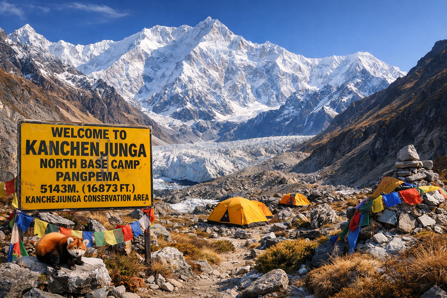
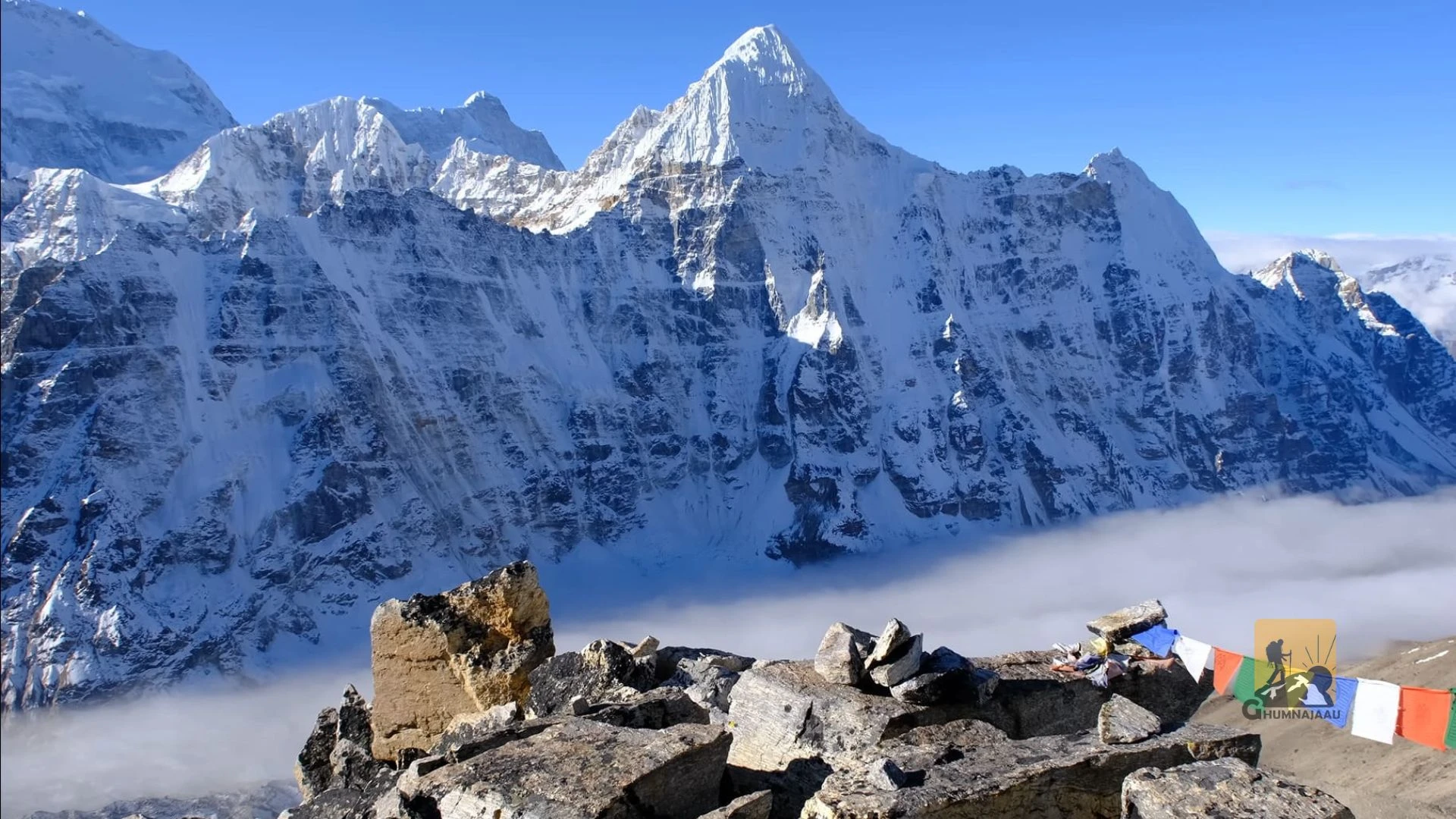
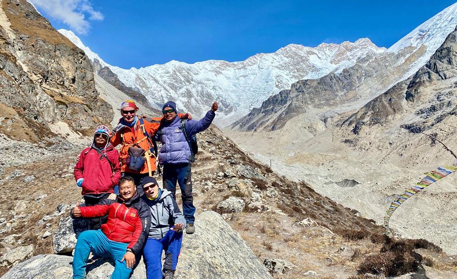
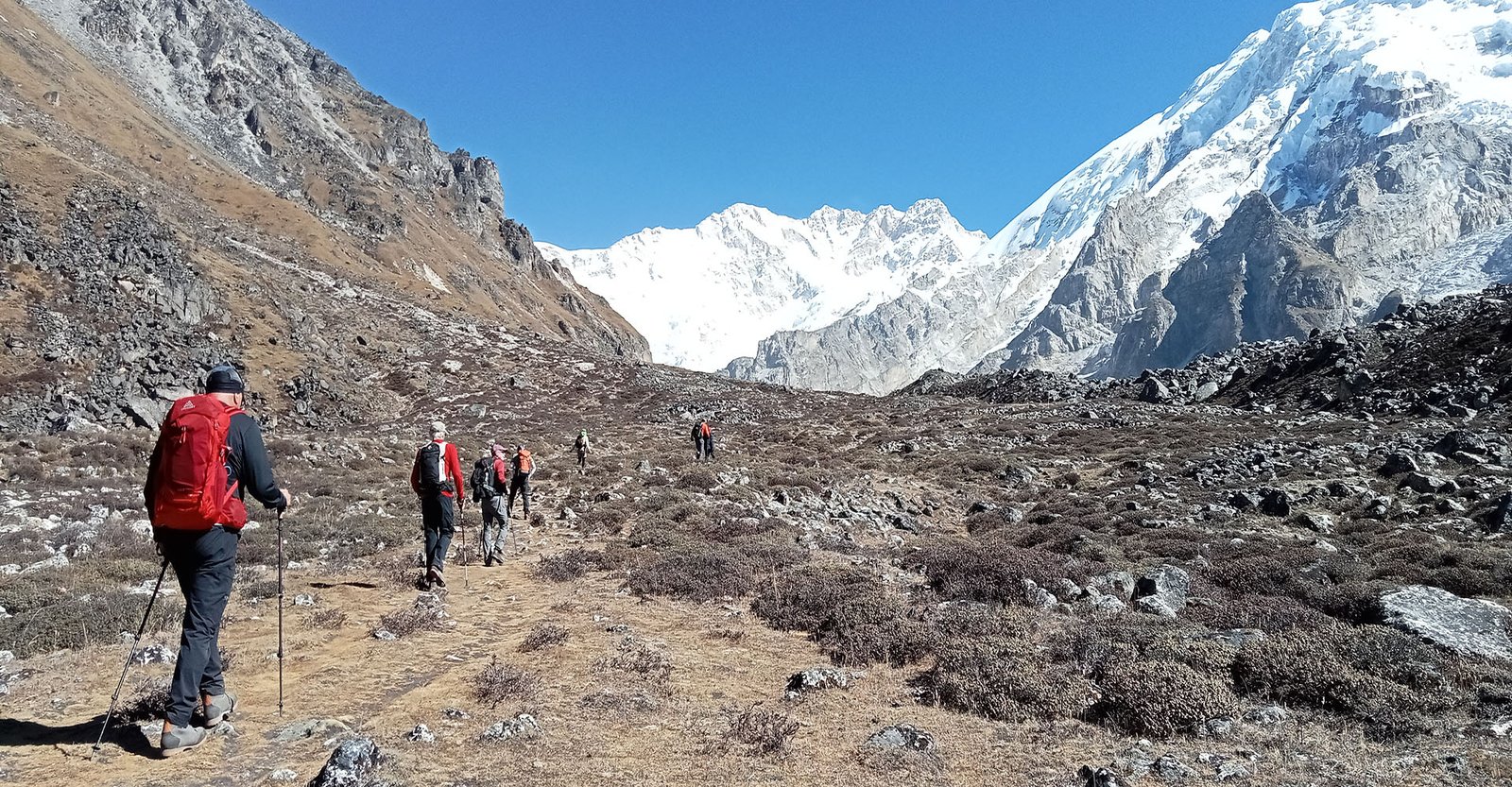
The Kanchenjunga Base Camp Trek is a challenging Himalayan adventure in eastern Nepal, taking trekkers into the remote landscapes surrounding Mount Kanchenjunga (8,586 m), the world’s third-highest mountain. Known for its dramatic peaks, glaciers, traditional villages and less-crowded trails, the region offers an unforgettable experience for those seeking a more remote trekking destination in Nepal.
The full Kanchenjunga Circuit Trek visits both Pangpema (North Base Camp) at 5,143 m and Oktang (South Base Camp viewpoint) at approximately 4,730 m. The route follows the northern Ghunsa Valley through settlements such as Amjilosa, Gyabla and Ghunsa, then continues towards Kambachen and Lhonak before reaching the spectacular northern face of Kanchenjunga.
After visiting Pangpema, the trail returns towards Ghunsa and crosses the challenging high passes of the Sele La region to enter the southern Yalung Valley. The journey continues through Tseram and Ramche to Oktang, where trekkers experience impressive views of Kanchenjunga and the surrounding glaciers from the southern side.
Along the way, the landscape changes from forested hills and traditional settlements to alpine meadows, rocky mountain slopes and glacial valleys. The trek also offers opportunities to experience the cultures of local Limbu, Rai, Sherpa and Tibetan-influenced communities, as well as the natural diversity of the Kanchenjunga Conservation Area.
With remote trails, demanding high-altitude crossings and visits to both base camp viewpoints, the Kanchenjunga Base Camp Trek is ideal for experienced trekkers looking for an extended Himalayan adventure beyond Nepal’s more popular trekking routes.
Overview
The 22-day Kanchenjunga Base Camp Trek takes you to both North Base Camp at Pangpema (5,143 m) and South Base Camp at Oktang (4,730 m), beneath the world’s third-highest mountain. Explore remote Himalayan villages, glacial valleys and challenging high passes on an unforgettable circuit through eastern Nepal.
Highlights
- Visit both North and South Base Camps of Mount Kanchenjunga.
- Reach Pangpema at 5,143 m, the highest point of the trek.
- Experience the spectacular north face of the world's third-highest mountain.
- Explore the southern Yalung Glacier and Oktang viewpoint.
- Cross the remote Sele La, Mirgin La, Sinion La and connecting high passes.
- Discover the traditional mountain settlements of Ghunsa, Kambachen and Tseram.
- Walk through rhododendron, oak, bamboo and alpine forests.
- Experience the cultures and hospitality of Limbu, Rai, Sherpa and Tibetan-influenced communities.
- Enjoy views of Jannu (Kumbhakarna), Kabru, Rathong and other Himalayan peaks.
- Explore the protected landscapes of the Kanchenjunga Conservation Area.
- Experience one of Nepal's most remote and less-crowded trekking regions.
- Complete a challenging Himalayan circuit combining mountain scenery, cultural experiences and high-altitude adventure.
Kanchenjunga Base Camp Trek Overview
The Kanchenjunga Base Camp Trek is a 22-day Himalayan circuit that explores the northern and southern sides of Mount Kanchenjunga, taking trekkers through one of the most remote mountain regions of Nepal. Reaching an altitude of 5,143 m at Pangpema, the trek combines high-altitude adventure with traditional villages, glacial valleys, forest trails and challenging mountain passes.
The journey begins in eastern Nepal and follows the Ghunsa Valley towards the northern base camp. After exploring Pangpema, the route crosses the high passes connecting the northern and southern sides of the mountain before reaching the Yalung Valley and Oktang viewpoint. The return journey follows forested trails and traditional settlements towards Taplejung.
With its two-base-camp route, varied landscapes and demanding high-altitude sections, this trek offers a comprehensive experience of the Kanchenjunga region. It is particularly suitable for experienced trekkers looking for a remote Himalayan adventure beyond Nepal’s more frequently visited trekking destinations.
The combination of Pangpema, Oktang, the Yalung Glacier, Ghunsa and the high mountain passes makes the Kanchenjunga Circuit a distinctive choice for travellers seeking an extended trekking experience in eastern Nepal.
What Can You Expect from the Kanchenjunga Base Camp Trek?
- A 22-day trekking experience through the remote Kanchenjunga region of eastern Nepal, with access to both sides of the world’s third-highest mountain.
- A challenging walk to Pangpema at 5,143 m, offering a close view of Kanchenjunga’s impressive northern face.
- A visit to Oktang at approximately 4,730 m, where the southern face of Kanchenjunga and the surrounding peaks create a dramatic mountain panorama.
- A gradual change in scenery from subtropical forests and terraced farmland to alpine meadows, rocky slopes and glacial valleys.
- Traditional settlements such as Sekathum, Amjilosa, Gyabla, Ghunsa, Kambachen and Tseram, each offering a different perspective of life in the eastern Himalayas.
- Opportunities to experience the traditions, architecture and hospitality of Limbu, Rai, Sherpa and Tibetan-influenced communities.
- High-altitude walking through the Ghunsa Valley, the Lhonak Glacier area and the upper Yalung Valley.
- Challenging mountain crossings through the Sele La pass system, including the connecting ridgelines around Mirgin La, Sinion La and Sinelapche La.
- Spectacular views of Jannu, Kabru, Rathong and other peaks of the Kanchenjunga range, depending on weather and visibility.
- A closer understanding of the natural environment of the Kanchenjunga Conservation Area, including its diverse forest and alpine habitats.
- Long trekking days that require stamina, steady pacing and the ability to adapt to changing weather and trail conditions.
- Basic mountain accommodation and local meals that reflect the practical realities of trekking in a remote Himalayan region.
- A genuine sense of remoteness, with fewer trekking groups and more isolated trails than many of Nepal’s established trekking destinations.
- A rewarding circuit experience that connects two base camp viewpoints instead of simply following one valley and returning along the same route.
Benefits of Booking the Kanchenjunga Base Camp Trek with TrekUp Nepal
- Travel with a locally based trekking company familiar with Nepal’s mountain routes, regional logistics and trekking arrangements.
- Receive assistance with the Kanchenjunga Restricted Area Permit and Kanchenjunga Conservation Area entry permit.
- Trek with a licensed guide who understands the route, altitude considerations, local conditions and safety requirements.
- Follow a carefully organized itinerary that includes preparation time, acclimatization and a contingency day.
- Benefit from coordinated transportation arrangements between Kathmandu, Bhadrapur, Taplejung and the trekking trailhead.
- Receive support from an organized trekking crew, including porters for carrying the main trekking baggage.
- Enjoy pre-departure guidance covering fitness preparation, trekking equipment, clothing and essential travel documents.
- Follow a route designed to include both Pangpema North Base Camp and Oktang South Base Camp.
- Receive assistance with accommodation, meals and local arrangements throughout the trekking journey.
- Travel with a team that can coordinate changes to the itinerary when weather, road conditions or trail circumstances require adjustments.
- Choose a private departure or request a customized group arrangement according to your travel dates.
- Receive clear information about the package inclusions, exclusions, permit arrangements and additional expenses before booking.
- Get assistance with emergency response coordination and evacuation arrangements when required, subject to the terms of your travel insurance and local conditions.
- Enjoy support before, during and after the trek from the TrekUp Nepal team.
Itinerary
The 22-day Kanchenjunga Base Camp Trek follows a complete circuit through eastern Nepal, visiting both Pangpema North Base Camp and Oktang South Base Camp. The route combines remote village trails, high-altitude glacier valleys, challenging mountain passes and traditional Himalayan settlements.
With gradual elevation gain, acclimatization time and a return through the southern Yalung Valley, this itinerary offers an extensive exploration of the Kanchenjunga region.
Arrive at Tribhuvan International Airport in Kathmandu, where a TrekUp Nepal representative will welcome you and transfer you to your hotel. After checking in, you can relax following your international journey or explore the nearby streets of Kathmandu. In the evening, meet your trekking guide for an introduction to the Kanchenjunga Base Camp Trek, including the route, general arrangements and important preparations for the journey.
Maximum Altitude: 1,400 m
Overnight Altitude: 1,400 m
Walking Duration: No trekking
Accommodation: Hotel in Kathmandu
Meals: Welcome dinner
Spend the day completing the necessary preparations for the Kanchenjunga Circuit Trek. Your guide will review the itinerary, check your trekking equipment and explain the altitude considerations, trail conditions and safety arrangements. TrekUp Nepal will coordinate the required Kanchenjunga Restricted Area Permit and Kanchenjunga Conservation Area entry permit. You will also have time to purchase or rent any remaining trekking equipment in Kathmandu before travelling to eastern Nepal.
Maximum Altitude: 1,400 m
Overnight Altitude: 1,400 m
Walking Duration: No trekking
Accommodation: Hotel in Kathmandu
Meals: Breakfast
Take a domestic flight from Kathmandu to Bhadrapur in southeastern Nepal. The flight provides views of the changing landscape from the Kathmandu Valley towards the eastern lowlands. After landing, continue by road towards Taplejung, travelling through the green hills, settlements and tea-growing areas of eastern Nepal. The journey is long and follows winding mountain roads, gradually bringing you closer to the Kanchenjunga region. Arrive in Taplejung and settle into your local accommodation for the night.
Maximum Altitude: Approximately 1,820 m
Overnight Altitude: Approximately 1,820 m
Walking Duration: No trekking; approximately 8–9 hours of driving
Accommodation: Local guesthouse in Taplejung
Meals: Breakfast, lunch and dinner
Continue from Taplejung towards Sekathum by local jeep along the rugged mountain road. The drive follows the river valleys and passes through small settlements, terraced hillsides and forested sections of the eastern hills. As the road moves deeper into the Kanchenjunga region, the surroundings become increasingly remote. Sekathum is an important starting point for the northern trekking route, situated near the meeting of the Ghunsa and Tamor river systems. After arrival, meet the local trekking support team and prepare for the walking section.
Maximum Altitude: Approximately 1,820 m
Overnight Altitude: Approximately 1,650 m
Walking Duration: No scheduled trekking; approximately 4–6 hours of driving
Accommodation: Local teahouse in Sekathum
Meals: Breakfast, lunch and dinner
Spend a day in Sekathum before beginning the sustained ascent towards the higher villages. This additional day provides time to recover from the long road journey, check equipment and prepare for the more demanding walking stages ahead. You may take a short walk around the settlement and nearby trails, depending on local conditions and the guide's recommendation. Your trekking guide will also review the walking pace, hydration routine and safety procedures for the remote sections of the route.
Maximum Altitude: Approximately 1,800 m on a short local walk
Overnight Altitude: Approximately 1,650 m
Walking Duration: Rest day; optional short walk
Accommodation: Local teahouse in Sekathum
Meals: Breakfast, lunch and dinner
Begin the trekking section by following the Ghunsa Khola through a narrow river valley. The trail passes suspension bridges, rocky paths and dense vegetation as it gradually climbs above the river. You will walk through forested sections with bamboo, oak and rhododendron, crossing streams and passing small settlements along the way. The route includes several ascents and descents, so a steady pace is important. As you approach Amjilosa, the surroundings become quieter and the settlement appears among the forested slopes. Overnight in this small mountain village.
Maximum Altitude: Approximately 2,510 m
Overnight Altitude: Approximately 2,510 m
Walking Duration: Approximately 5–7 hours
Accommodation: Basic teahouse in Amjilosa
Meals: Breakfast, lunch and dinner
Continue north along the Ghunsa Khola, following a trail that passes through thick forest and steep valley sections. The route gradually gains elevation, with sections of bamboo, rhododendron and mixed woodland along the hillside. You will cross streams and walk through increasingly open sections of the valley as the landscape begins to change. Prayer flags and Buddhist features become more noticeable as you approach the upper settlements. Gyabla, also known as Kyapra, is a small traditional village surrounded by mountain slopes and forest. Arrive in the afternoon and settle into a local teahouse.
Maximum Altitude: Approximately 2,730 m
Overnight Altitude: Approximately 2,730 m
Walking Duration: Approximately 4–6 hours
Accommodation: Basic teahouse in Gyabla
Meals: Breakfast, lunch and dinner
Today's trail continues through the upper Ghunsa Valley, crossing streams and forested slopes before reaching Phale, a settlement associated with Tibetan cultural traditions. The path then climbs gradually through fir and juniper forest towards Ghunsa, one of the largest and most important villages in the Kanchenjunga region. Ghunsa is known for its traditional stone houses, monasteries, prayer flags and strong mountain culture. It also serves as a key acclimatization stop before entering the higher glacial valley. After reaching the village, take time to rest and explore the surroundings if conditions permit.
Maximum Altitude: Approximately 3,417 m
Overnight Altitude: Approximately 3,417 m
Walking Duration: Approximately 4–6 hours
Accommodation: Local teahouse in Ghunsa
Meals: Breakfast, lunch and dinner
Spend an important acclimatization day in Ghunsa before continuing towards Kambachen and Lhonak. A gradual walk to a higher viewpoint above the village may be arranged to help your body adjust to the increasing elevation. The surrounding landscape offers views of the upper Ghunsa Valley and the impressive Jannu massif. After the walk, return to Ghunsa for lunch and a relaxed afternoon. You may also visit a local monastery or explore the village while learning about the traditions of the communities living in this remote mountain region. Your guide will monitor your condition before the next stage.
Maximum Altitude: Approximately 3,900–4,000 m on the acclimatization walk
Overnight Altitude: Approximately 3,417 m
Walking Duration: Approximately 2–4 hours, depending on the acclimatization walk
Accommodation: Local teahouse in Ghunsa
Meals: Breakfast, lunch and dinner
Leave Ghunsa and follow the upper Ghunsa Khola towards Kambachen. The trail gradually moves beyond the denser forest and enters a more open alpine environment. You will pass rocky slopes, glacial streams, scattered vegetation and areas of exposed moraine. The views become increasingly dramatic as the valley opens towards the surrounding Himalayan peaks. Jannu, also known as Kumbhakarna, is a particularly impressive presence along this section. Kambachen is a small high-altitude settlement surrounded by rugged mountain terrain and provides an important overnight stop before the approach to Lhonak.
Maximum Altitude: Approximately 4,050 m
Overnight Altitude: Approximately 4,050 m
Walking Duration: Approximately 4–6 hours
Accommodation: Basic teahouse in Kambachen
Meals: Breakfast, lunch and dinner
Continue deeper into the northern Kanchenjunga region, following the glacial valley towards Lhonak. The trail passes rocky terrain, landslide sections and moraine landscapes formed by the surrounding glaciers. Vegetation becomes increasingly sparse as you gain altitude, while the views open towards the high Himalayan peaks, including Wedge Peak, Nepal Peak, Mera Peak and the surrounding mountain walls. The route requires careful footing, particularly on loose or uneven sections. Lhonak is a remote high-altitude settlement near the Lhonak Glacier and serves as the final overnight stop before the North Base Camp excursion.
Maximum Altitude: Approximately 4,780 m
Overnight Altitude: Approximately 4,780 m
Walking Duration: Approximately 4–6 hours
Accommodation: Basic teahouse in Lhonak
Meals: Breakfast, lunch and dinner
Start early for the trek to Pangpema, the North Base Camp of Mount Kanchenjunga. The trail follows the rugged terrain beside the Lhonak Glacier, crossing rocky moraine and exposed high-altitude sections. As you approach Pangpema, the northern face of Kanchenjunga gradually dominates the landscape, creating an extraordinary mountain panorama. At approximately 5,143 m, Pangpema is the highest point of the entire itinerary and the main highlight of the northern route. Spend time enjoying the views and photographing the surrounding peaks, subject to weather and trail conditions. After visiting the viewpoint, retrace the route carefully and descend to Lhonak for the night.
Maximum Altitude: 5,143 m at Pangpema
Overnight Altitude: Approximately 4,780 m
Walking Duration: Approximately 6–8 hours
Accommodation: Basic teahouse in Lhonak
Meals: Breakfast, lunch and dinner
Begin the return journey from Lhonak, retracing the northern trail through the glacial valley towards Kambachen. The route involves a substantial descent, allowing you to gradually leave the highest section of the Kanchenjunga region behind. Continue through the rocky landscape and alpine slopes before following the Ghunsa Khola towards the forested valley. As you lose elevation, the air becomes warmer and vegetation gradually returns. Reach Ghunsa by afternoon and enjoy a comfortable rest after the demanding North Base Camp excursion.
Maximum Altitude: Approximately 4,780 m
Overnight Altitude: Approximately 3,417 m
Walking Duration: Approximately 6–8 hours
Accommodation: Local teahouse in Ghunsa
Meals: Breakfast, lunch and dinner
Leave Ghunsa and climb towards the high ridgeline connecting the northern and southern sides of the Kanchenjunga massif. The trail ascends through forested slopes before entering more exposed terrain with shrubs, rocky sections and open mountain views. As the elevation increases, the vegetation becomes thinner and the route takes on a distinctly alpine character. Reach Sele Le High Camp, also known as Sele Le Kharka, where the surrounding ridgelines provide a sense of the challenging pass crossing ahead. The overnight stop is basic and facilities may be limited depending on the season.
Maximum Altitude: Approximately 4,200–4,300 m
Overnight Altitude: Approximately 4,200 m
Walking Duration: Approximately 4–6 hours
Accommodation: Basic teahouse or seasonal lodge at Sele Le
Meals: Breakfast, lunch and dinner
This is one of the most demanding and memorable days of the Kanchenjunga Circuit Trek. Begin early and cross the high mountain passes linking the Ghunsa Valley with the southern Yalung Valley. Depending on the precise trail conditions and route followed, the crossing includes Sele La, Sinion La, Mirgin La and Sinelapche La. The trail moves across exposed ridgelines, rocky paths and potentially snow-covered sections, with wide views of Kanchenjunga, Jannu and other Himalayan peaks on clear days. After completing the high crossings, descend towards Tseram through the southern mountain landscape. This is a long day at altitude, and the group must remain together and follow the guide's instructions throughout the crossing.
Maximum Altitude: Approximately 4,600–4,650 m at the highest connecting pass, depending on the route
Overnight Altitude: Approximately 3,870 m
Walking Duration: Approximately 7–9 hours
Accommodation: Basic teahouse in Tseram
Meals: Breakfast, lunch and dinner
Continue towards Ramche along the upper Yalung Valley, following a trail that gradually climbs beside the Yalung Glacier. The landscape is a mixture of alpine meadows, rocky ground and glacial terrain, with increasingly impressive views of the southern Kanchenjunga range. The walk is shorter than the previous pass-crossing day, allowing time to appreciate the mountain surroundings and adjust to the elevation. Ramche is a remote high-altitude settlement and an important overnight point for the South Base Camp excursion. After arrival, rest and prepare for the following day's walk towards Oktang.
Maximum Altitude: Approximately 4,580 m
Overnight Altitude: Approximately 4,580 m
Walking Duration: Approximately 3–5 hours
Accommodation: Basic teahouse or seasonal lodge in Ramche
Meals: Breakfast, lunch and dinner
Set out early from Ramche and follow the trail towards Oktang, the South Base Camp viewpoint of Mount Kanchenjunga. The route follows the upper Yalung Glacier valley through rugged moraine and open alpine terrain. As you approach Oktang, the southern face of Kanchenjunga and its surrounding peaks come into view, offering a completely different perspective from the northern panorama at Pangpema. At approximately 4,730 m, Oktang is one of the most memorable destinations on the southern side of the mountain. After spending time at the viewpoint, retrace the route and descend to Tseram for the night.
Maximum Altitude: Approximately 4,730 m at Oktang
Overnight Altitude: Approximately 3,870 m
Walking Duration: Approximately 5–7 hours
Accommodation: Basic teahouse in Tseram
Meals: Breakfast, lunch and dinner
Begin the descent from the upper Yalung Valley towards Torangdin, also known as Tortong. The trail follows the Simbua Khola through a combination of rocky paths, forested slopes and descending mountain terrain. As you lose elevation, the alpine surroundings gradually give way to greener vegetation, streams and wooded sections. This stage provides a noticeable change from the exposed high-altitude landscape of the previous days. Reach Torangdin and settle into a local teahouse for the night.
Maximum Altitude: Approximately 3,870 m
Overnight Altitude: Approximately 2,995 m
Walking Duration: Approximately 5–7 hours
Accommodation: Basic teahouse in Torangdin
Meals: Breakfast, lunch and dinner
Continue descending through the southern side of the Kanchenjunga region, following forest trails, river sections and traditional hillside settlements. The route passes through changing vegetation and warmer terrain as you move away from the high mountain environment. Along the way, there may be occasional views back towards the surrounding ridges and the distant Kanchenjunga massif. Yasang provides a quieter overnight stop along the return route, where you can rest after another full day of walking.
Maximum Altitude: Approximately 2,995 m
Overnight Altitude: Approximately 2,144 m
Walking Duration: Approximately 5–7 hours
Accommodation: Local teahouse in Yasang
Meals: Breakfast, lunch and dinner
Complete the final walking section by following the trail towards Hellok through forested hillsides, small settlements and river valleys. Meet the waiting vehicle at the road-accessible point and continue by jeep towards Taplejung. The drive follows the rugged roads of eastern Nepal, returning you to the main town after completing the circuit. Arrive in Taplejung and enjoy a well-earned rest after visiting both sides of Mount Kanchenjunga.
Maximum Altitude: Approximately 2,144 m
Overnight Altitude: Approximately 1,820 m
Walking Duration: Approximately 2–3 hours of walking, followed by a road journey
Accommodation: Local guesthouse in Taplejung
Meals: Breakfast, lunch and dinner
Leave Taplejung early and drive back towards Bhadrapur through the winding roads and green hills of eastern Nepal. The journey takes several hours and provides a final opportunity to appreciate the landscapes of the region. On reaching Bhadrapur, board your domestic flight back to Kathmandu, subject to the flight schedule and weather conditions. Upon arrival, transfer to your hotel and enjoy a relaxing evening in the capital.
Maximum Altitude: Approximately 1,820 m during the drive
Overnight Altitude: Approximately 1,400 m
Walking Duration: No trekking; approximately 8–9 hours of driving and a domestic flight
Accommodation: Hotel in Kathmandu
Meals: Breakfast
Keep this day available for rest after completing the remote Kanchenjunga Circuit Trek. It also provides an important travel buffer in case road conditions, flight delays or weather disruptions affect the return journey from eastern Nepal. You may spend the day relaxing at your hotel, exploring Kathmandu or visiting nearby cultural attractions. If the return journey operates as scheduled, this day offers a comfortable break before your international departure.
Maximum Altitude: 1,400 m
Overnight Altitude: 1,400 m
Walking Duration: No trekking
Accommodation: Hotel in Kathmandu
Meals: Breakfast
Your Kanchenjunga Base Camp Trek concludes today. Depending on your international flight schedule, enjoy breakfast at the hotel before checking out. A TrekUp Nepal representative will arrange your transfer to Tribhuvan International Airport. Depart Nepal with lasting memories of Pangpema, Oktang, the high mountain passes and the remote Himalayan communities encountered throughout the journey.
Maximum Altitude: 1,400 m
Overnight Altitude: Not applicable
Walking Duration: No trekking
Accommodation: Not applicable
Meals: Breakfast
Includes/Excludes
Cost Includes
- Airport pickup and drop-off in Kathmandu by private vehicle.
- Three-star hotel accommodation in Kathmandu on a twin-sharing basis.
- Domestic flight from Kathmandu to Bhadrapur and return.
- Ground transportation between Bhadrapur, Taplejung, Sekathum and the return route as outlined in the itinerary.
- Local jeep transportation required during the trekking itinerary.
- Teahouse and local lodge accommodation throughout the trek.
- Breakfast, lunch and dinner during the trekking section.
- Breakfast during the Kathmandu hotel stay.
- Welcome dinner in Kathmandu.
- Licensed English-speaking trekking guide.
- Porters to carry trekking baggage, normally one porter for two trekkers.
- Food, accommodation, insurance and wages for the trekking crew.
- Kanchenjunga Restricted Area Permit arrangements.
- Kanchenjunga Conservation Area entry permit.
- Trekking equipment for the support team.
- First-aid kit carried by the trekking team.
- Trek briefing and itinerary coordination.
- Government taxes and applicable service charges.
- Trek completion certificate from TrekUp Nepal.
Cost Excludes
- International airfare to and from Nepal.
- Nepal entry visa fees.
- Personal travel insurance and emergency helicopter evacuation coverage.
- Personal trekking equipment, clothing, trekking boots and sleeping bag unless specifically included in the booking.
- Lunch and dinner in Kathmandu.
- Additional hotel nights caused by early arrival, late departure or itinerary changes.
- Personal expenses such as snacks, bottled drinks, hot showers, Wi-Fi and charging fees.
- Alcoholic beverages and additional drinks.
- Tips for guides, porters and drivers.
- Extra transportation or accommodation caused by delays, bad weather or unforeseen circumstances.
- Costs arising from natural disasters, political disturbances or other events beyond the company's control.
- Any service not specifically mentioned under the cost-includes section.
Add-ons and Options
Private Jeep Transportation
Upgrade selected road journeys between Bhadrapur, Taplejung and the trekking trailhead with private jeep transportation for greater flexibility and comfort.
Additional Porter Service
Arrange an additional porter if you prefer to carry less weight or require extra baggage support during the trek.
Extra Acclimatization Days
Add rest and acclimatization days at suitable locations such as Ghunsa or other appropriate stops according to your experience, health and itinerary requirements.
Private Trekking Guide
Request a dedicated guide for a private trekking experience, subject to availability and the required group-support arrangements.
Single Room in Kathmandu
Upgrade to a private room during your hotel stay in Kathmandu, subject to hotel availability and an additional charge.
Additional Kathmandu Hotel Nights
Extend your stay before or after the trek for sightseeing, shopping, rest or other travel arrangements.
Sleeping Bag and Down Jacket Rental
Arrange rental of essential cold-weather equipment in Kathmandu if you do not wish to purchase or bring these items from home.
Ilam and Kanyam Extension
Add a short eastern Nepal extension to explore the tea gardens and scenic hill landscapes around Ilam and Kanyam, depending on the return route and available time.
Customized Private Departure
Arrange a private Kanchenjunga Base Camp Trek departure with adjusted dates, additional rest days or selected transportation and accommodation upgrades.
Prices for add-ons depend on group size, availability, transportation requirements and the selected services. Confirm the final cost with TrekUp Nepal before booking.
Best Time to Do the Kanchenjunga Base Camp Trek
The best time for the Kanchenjunga Base Camp Trek is during spring (March to May) and autumn (September to November). These seasons generally provide more favourable trekking conditions, better mountain visibility and more reliable opportunities for crossing the high passes.
Spring (March to May)
Spring is one of the most attractive seasons for trekking in the Kanchenjunga region. The lower forests become greener, rhododendron blooms add colour to the trails and temperatures gradually become warmer. The higher sections can still have snow, particularly around the mountain passes, but conditions generally improve as the season progresses. April and May are particularly popular for trekkers seeking a combination of mountain scenery and spring landscapes.
Autumn (September to November)
Autumn is another excellent season for the Kanchenjunga Circuit. Following the monsoon, the skies often become clearer, mountain visibility improves and the trails gradually become more suitable for high-altitude trekking. October and early November are particularly favourable for panoramic mountain views and pass crossings, although temperatures become colder as winter approaches.
What Our Travelers Say
Read reviews from travelers who have joined our Himalayan trips. See what they enjoyed and what they thought about their experience.
Frequently Asked Questions
Faq's
The full Kanchenjunga Circuit Trek takes approximately 22 days, including arrival, preparation, travel to the trailhead, trekking, return transportation and departure. The duration can vary depending on the selected route and additional acclimatization or contingency days.
The maximum altitude is approximately 5,143 m (16,873 ft) at Pangpema, the North Base Camp of Mount Kanchenjunga. The South Base Camp viewpoint at Oktang is approximately 4,730 m.
Yes. This full circuit itinerary visits Pangpema on the northern side and Oktang on the southern side of Mount Kanchenjunga. It also crosses the high mountain passes connecting the two valleys.
The trek is graded challenging to very strenuous. It involves long walking days, steep ascents and descents, remote trails, high-altitude conditions and demanding mountain passes. Previous high-altitude trekking experience and good physical fitness are strongly recommended.
Previous trekking experience is highly recommended, particularly experience at elevations above 4,000 m. Trekkers should be comfortable walking for several consecutive days, sometimes for 6–9 hours, across uneven and exposed mountain terrain.
Spring (March to May) and autumn (September to November) are the best seasons. These periods generally offer more favourable weather, better trail conditions and clearer mountain views.
Yes. The route requires a Kanchenjunga Restricted Area Permit and a Kanchenjunga Conservation Area entry permit. The restricted-area permit must be arranged through a registered trekking agency, and a licensed guide is mandatory.
You may book as an individual traveller, but you cannot undertake the restricted-area trek independently without a licensed guide and registered agency arrangements. Nepal's restricted-area permit rules were revised in March 2026 to allow individual applicants, while the guide and agency requirements remain in place.
Yes. A licensed trekking guide is compulsory for the restricted-area section. The guide assists with route navigation, permits, safety monitoring, local arrangements and communication with the trekking support team.
Accommodation is mainly in basic local teahouses and mountain lodges. Facilities are more limited than in popular trekking regions such as Everest and Annapurna. Some high-altitude stops have very simple rooms and shared facilities. Arrangements may need to change according to seasonal lodge availability and trail conditions.
Common meals include dal bhat, rice, noodles, soups, potatoes, vegetables, eggs, porridge and basic breakfast options. Food choices become more limited at higher elevations, so trekkers should be prepared for simple meals during the remote sections.
Yes. The itinerary includes a preparation and rest period at Sekathum and an acclimatization day at Ghunsa. The guide will monitor your condition and adjust the pace or route if necessary. Additional acclimatization days can be arranged when required.
Yes. The route reaches above 5,000 m, and altitude sickness is a serious consideration. Gradual ascent, appropriate acclimatization, hydration and monitoring for symptoms are essential. Any symptoms such as headache, nausea, dizziness or unusual breathlessness should be reported to the guide immediately.
Most trekking days involve approximately 4–8 hours of walking. The high-pass crossing and the Pangpema excursion may require longer, depending on weather, trail conditions and the group's pace.
It is not generally recommended for first-time trekkers without previous experience at altitude. The long duration, remoteness, basic accommodation and demanding high-altitude sections make it more suitable for experienced and physically prepared trekkers.
Mobile coverage and internet access are limited and unreliable throughout much of the Kanchenjunga region. Some villages may have occasional network coverage, but trekkers should not expect continuous connectivity. Carrying a power bank and informing family members about the limited communication facilities is recommended.
Charging facilities may be available in some teahouses, usually for an additional fee. Facilities become more limited at higher elevations, so carrying a suitable power bank and spare batteries is recommended.
Essential equipment includes insulated layers, a down jacket, waterproof jacket and trousers, thermal clothing, trekking boots, warm gloves, a hat, sunglasses, sunscreen, a sleeping bag suitable for cold temperatures, trekking poles, a headlamp and a comfortable daypack. Your guide will provide a detailed packing list before departure.
Yes. Comprehensive travel insurance is strongly recommended. It should cover high-altitude trekking up to at least 5,500 m and emergency helicopter evacuation, medical treatment and trip interruption where applicable.
Yes. Porters can carry the main trekking baggage, allowing you to walk with a lighter daypack. A typical arrangement is one porter for two trekkers, with the exact baggage allowance confirmed before departure.
Yes. TrekUp Nepal can arrange private departures, additional acclimatization days, alternative travel arrangements, extra Kathmandu accommodation and other itinerary adjustments according to your schedule and requirements.
Weather and road conditions can affect transportation in eastern Nepal. The itinerary includes a contingency day in Kathmandu, but additional delays may require changes to the schedule. Travellers should maintain flexibility and have suitable travel insurance.